Tag Archives: Australia 2014

Warrumbungle National Park

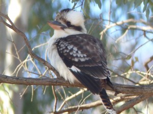
One of a pair of Kookaburras that came to check us out when we were setting up camp

One of a pair of Kookaburras that came to check us out when we were setting up camp

As anticipated we had a steady start this morning, in fact it was nearer afternoon by the time we hit the road ๐Ÿ™‚ Our thanks as ever to Jim and Sue for their hospitality.
We headed north from Trangie through Gin Gin and Collie before heading east to the Newell Highway at Gilgandra.
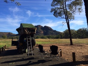
As we travelled east we could see a mountain range getting closer and closer which marked the Warrumbungle National Park. As the timing was about right for an overnight stop and we liked the look of it we headed into the park for the night.
The views and the wildlife inside the park make it a really pleasant place to stay. There seems to be a large kangaroo population and lots of bird life with Kookaburras and Lorikeets making their presence felt almost as soon as we made camp.

View from our camping spot of one of the mountains

View from our camping spot of one of the mountains

I think the next few days will comprise of much shorter hops rather than the long 500km days we’ve been doing recently as there are so many places to visit. We’re still heading on a very rough north east track but beyond that we’ll be taking this part of the journey as it comes. In many ways the final leg of the journey starts here.

Trangie

Much better weather this morning - a real contrast to yesterday's picture.

Much better weather this morning – a real contrast to yesterday’s picture.

The weather was more or less back to normal this morning after yesterday’s and last night’s storms. For the most part we were back to clear blue skies although a heavy dew meant the outside of the tent was quite wet. We stayed at Nyngan for a while to let the tent dry out in the sun before packing it away and setting off.
The trip to Trangie is only a short hop from Nyngan so we got there early and kept going to Dubbo so we could do a full shop and restock everything before returning to Trangie. With that done it meant we were set to head north from Trangie after spending the night there.
It was good to catch up with Jim and Sue again, now in their new house, and we had the luxury of sleeping in a proper bedroom again.
Tomorrow I expect we’ll start a bit late with a steady start to the day and head north and see where we end up camping when we get there. We have a list of possible places to visit from Jim and Sue so it’s given us some very rough plans on where we’ll go over the next few weeks.

Nyngan

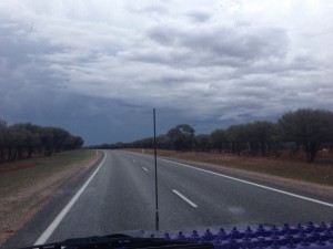
Heading into the storm on the Barrier Highway towards Cobar

Heading into the storm on the Barrier Highway towards Cobar

We’ve had a very steady day today as we’ve continued our eastward journey. At around 3am this morning the rain arrived and by the time we got up the rain was accompanied by thunder and lightning. It was fairly patchy though so we managed to get everything packed away and got ourselves sorted in the gaps between showers. Very glad we decided to put the fly sheet on the tent before we left Broken Hill or we might have got a bit wet !
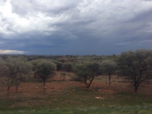
As we headed east we were treated to displays of forked lightning in the distance, eventually catching up with the storm and passing through it with some very heavy rain along the way. The Land Rover is looking a little bit cleaner but not much…

Another view of the gathering storm clouds.

Another view of the gathering storm clouds.

Once we got ahead of the storm we were back into bright sunshine again but whenever we stopped for too long it would catch us up. During one of these stops we fixed the main tank fuel gauge which has been stuck reading full since the second day of the Simpson Desert crossing. The sender arm keeps sticking for some reason inside the tank. Normally a decent bump in the road will fix it but it’s stayed firmly stuck despite climbing sand dunes, rattling along corrugated roads and driving up creek beds and rock climbs at Eldee. The sender unit is now fully sealed to the top of the tank since the Tom Price fuel leak so I can’t take it out and reposition it. Fortunately removing the inspection plate above the tank (after removing the fridge and all the wolf boxes first) gives access to the top of the sender unit and hitting the top of it repeatedly with the wheel brace got it “unstuck”. Hopefully it’ll stay unstuck now although it’s not a major issue, because we know roughly how many miles we get from a tank, it Is quite annoying.
Tomorrow we’ll head south east to Trangie to visit Jim and Sue before we start heading north into Queensland.

Wilcannia

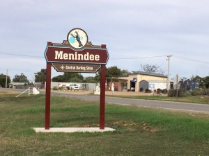
Menindee, the filling station is in the background.

Menindee, the filling station is in the background.

Our first destination this morning was Silver City 4×4 to get the propshafts greased and to check that the whining noise the Land Rover has been making is actually the tyres and not a problem with the front axle.
It turns out that they’ve moved since the last time we visited (2008) and now have a shiny new ARB dealership and much bigger premises. Anyway, they squeezed us in and got the propshafts done and confirmed, as I’d suspected, the axle seemed fine and it was probably just the tyres that have feathered. I’ve already rotated the tyres so hopefully it’ll even out again.
Silver City 4×4 were a big part of the OBC offering workshop facilities and assistance throughout the event.
We then left Broken Hill to head South East to yet another OBC landmark, Menindee. I’ve only ever seen Menindi in the dark, often late at night, and then we’ve only seen the fuel station on the edge of town. We would fill up there at least once during the event and lots of the local kids would come out to see the competition vehicles and ask for stickers from sponsors. Looking round it today it turns out it’s a fairly big town with some well preserved old buildings scattered around the town.

A quick stop alongside the river at Viewmont

A quick stop alongside the river at Viewmont

From Menindi we headed to the south side of the Darling River onto the unsurfaced road to Wilcania. I’m afraid this is yet another OBC throwback as the Viewmont competition area runs alongside this track. Viewmont was always a challenging venue because we spent a LOT of our time driving through very deep water and the clay mud got everywhere. It was Viewmont that killed Neil’s truck in 2008 and nearly finished off Gary’s Range Rover. We stopped off at the cleaning area where we also spent some time welding his axle back together.
The unsealed road to Wilcania is a really nice road to drive. As well as the scenery alongside the river the soft bull dust and sand meant that the going was nice and smooth but occasionally you’d hit bull dust with one wheel that would throw the Land Rover across the road. Just as I remembered it from the OBC (don’t worry, not many more OBC references to go !). Not too many sideways moments, just enough to have a good “play” ๐Ÿ™‚
Tomorrow we’re expecting the weather to take a turn for the worst with showers and possibly a storm forecast. We’ll continue east, sticking to surfaced roads probably heading to Nyngan.

Broken Hill

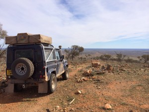
One of my favourite views of Australia from one of the peaks above Eldee Station

One of my favourite views of Australia from one of the peaks above Eldee Station

To start the day off today we relived some of the 2005 Outback Challenge by driving most of the route the final three stages covered although we took the easy route around the winch section !
For me the final navigation stage of the 2005 event was my favourite and I’ve always remembered the amazing views near the end of the stage where we climbed to the top of a high peak overlooking the Mundi Mundi plain. Given it’s nearly ten years since I drove it I was surprised how much of it I remembered although, as everywhere, it’s a lot greener now. The view near the end of the stage was as spectacular as I remembered it and the creek bed and the rest of the terrain are all typical of the OBC so it was great to have a chance to drive it again, albeit at a slower pace…

Another view from the loop at Eldee Station

Another view from the loop at Eldee Station

After checking back in with the station to let them know we had completed it and were safe we headed to Broken Hill and the supermarket before booking into the camp site. All very mundane after a morning driving around the bush.
Tomorrow we’ll pay a visit to Silver City 4×4 to see if I can get the propshafts greased before we head east to start what is really the final stage of our journey, heading eventually to the Queensland coast in the north before returning along the coast to Sydney.

Eldee Station

imageVery much a tourist day today. Our first port of call was to visit the Daydream mine between Silverton and Broken Hill. We went on their guided tour which comprises a short above ground walk followed by a trip underground to see the mine workings. After the tour they serve scones with jam and cream and very nice they were too ๐Ÿ™‚
From Daydream Mine we headed back to Silverton to have a look around the remaining buildings in the town. We thought about visiting the Mad Max 2 museum (Mad Max 2 was filmed in the area and there are a lot of film props around). In the end we decided not to bother as admission was a bit expensive and it looked from the outside like a 10 foot square room !
We had a wander around the prison museum though which was cheaper and a LOT bigger.

The Mundi Mundi lookout

The Mundi Mundi lookout

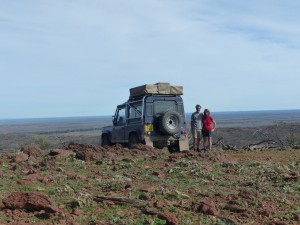
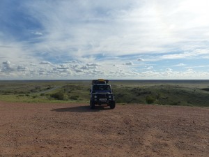
From Silverton we headed to the Mundi Mundi lookout which overlooks the vast Mundi Mundi plain. It’s all a lot greener than last time we were here, the picture of my Defender that originally featured at the top of this web site was taken there in 2005 and we tried to reproduce the picture with the 90 this time.
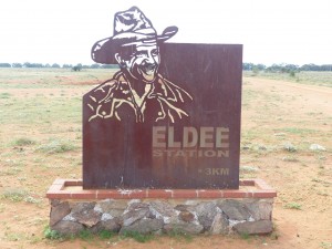
From Mundi Mundi we continued north to Eldee Station, the central point for the 2005 Outback Challenge and also the venue for the final day of the competition. On arriving we had a chat with Steve the owner and he confirmed that the self guided loop that they offer follows the course of the final navigation stage. That was probably the best stage of the event for me and I’ve always remembered it so having the opportunity to drive it again couldn’t be missed.

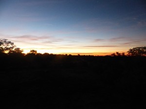
Sunset at Eldee Station

Sunset at Eldee Station

Tomorrow we’ll have a drive around the loop and then head into Broken Hill where we need to do mundane things like a supermarket shopping trip to stock up on food and beer. We’ll stop the night at Broken Hill before heading east on Monday.

Silverton

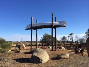
Sturt boat sculpture

Sturt boat sculpture

We had an excellent night last night, we decided to give the Family Hotel a try (There are two pubs to choose from in Tibooburra). The food was really good, the beer cold and we had a good natter with the staff afterwards. A really enjoyable night all in all.
This morning we visited the Sturt boat artwork. Sturt was one of a number of Victorian gents who, being of their time, were convinced that Australia must contain an inland sea. He assembled an expedition and equipment, including a whaling boat and a cart to carry it on and headed north from Adelaide to find this large inland sea. I’m not sure myself if it’s to his credit that he persisted in the venture as rise after rise, sand dune crest after sand dune crest, revealed yet more arid landscape. Either he was a strong character who was so adamant that the “inland sea” theory was correct or an idiot who didn’t know when to give up. Anyway, to commemorate his expedition an artist has created an exact replica of the boat and put it on some poles. The boat itself was abandoned when Sturt finally saw sense and headed south, never having actually sailed it on the inland sea. Sturt did document his travels though and opened up new areas of the outback as a result. His recommendations and observations of the terrain and fauna allowed others to follow in his footsteps.

Packsaddle Roadhouse on the Silver City Highway

Packsaddle Roadhouse on the Silver City Highway

This area seems to be scattered with sites and memorials to the ill conceived expedition and our north to south journey has taken in evidence and locations for three celebrated expeditions. The Sturt ย expedition, the McDonnell Stuart expedition and the Burke and Wills expedition. (Burke and Wills infamously died trying to make the south to north crossing having missed their rescue party by 8 hours).
From Tibooburra we headed south along the Silver City Highway to Milparinka, a partially reconstructed gold mining town that was abandoned in the 1920s. There is also a Sturt connection just down the road from the town where the Sturt cairnis located – a cairn that Sturt persuaded his men to build to keep them out of mischief while they waited out a drought period. The reconstructed buildings are an interesting relic of the time and, similar to some UK historical sites, rely heavily on volunteers to keep them open and funded.
From Milparinka we headed south again to a major landmark from the Outback Challenge competition – the Packsaddle roadhouse. During the OBC this was a regular stop for fuel for all the competitors, normally arriving late at night after a days competiton and taking the opportunity to fill up on fuel and food at the same time. We had a steak sandwich with “the lot” as that’s what we had during the competition and it still tastes good, even in the daylight ๐Ÿ™‚
imageContinuing south we eventually got to Broken Hill which is as confusing a town now as it always was with road signs only being thought necessary every 3-4 major junctions. Thanks to Apple maps we found our way to the Silverton road and headed out, by this time heading into a low, setting sun, to Silverton where we are camped for the night. The camp site is only a few minutes walk from the Silverton hotel which, once again, was as frequent a stop on the OBC as we could make it during the competition and was always a popular spot to gather after the competition ended.
Mad Max II was filmed in this area and along the Silverton road and one of the movie cars used to be parked outside the hotel. It has now gone but there is a Mad Max museum that now houses the car and we’ll no doubt visit that tomorrow. For now we’re about to take a walk to the pub and have a well earned beer or maybe two.
Tomorrow we hope to do some of the tourist things in the immediate area before heading to Eldee Station to camp tomorrow night. Eldee hosted the final part of the competiton when I competed in 2005 and offers self guided 4×4 tours that I’m hoping will take in some of the amazing navigation stages we did back then.

Tibooburra

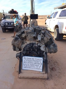
The remains of a Bristol Hercules engine at Innaminka

The remains of a Bristol Hercules engine at Innaminka

A bit of a transit day today as we headed away from Innaminka to Cameron Corner and then on to Tibooburra which sits on the Silver City Highway. There are a number of routes from Innaminka to Cameron Corner (all unsurfaced) and we opted to use the Old Strzelecki Track after checking it’s condition at the Innaminka Trading Post.

When I went to fill up at the Trading Post I couldn’t help but notice the remains of a Bristol Hercules engine at the end of the pumps. Until last year it wouldn’t have meant much but as Patrick at Maddison 4×4 has two that he’s preparing for a running display I know a fair bit about this particular engine and how it works. It’s got some clever design features including the fact that the cylinder sleeve itself moves to open and close the inlet and exhaust ports, all timed and controlled by an intricate set of gears like a clock – the remains of some of the gears can be seen in the picture. If you want to see what a complete engine looks like, visit Patrick’s blog…
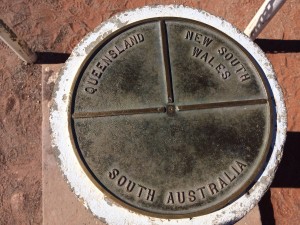
Cameron Corner marker plate

Cameron Corner marker plate

We followed the Old Strzelecki south to Merty Merty where we split from it where it meets the Strzelecki Track (the new one !). We then followed an unnamed track south and then east into Cameron Corner. Cameron Corner marks the corner where three states join – South Australia, New South Wales and Queensland. To add to the confusion of which road is in which state the Dingo fence also runs through the border here. We took the mandatory picture of the official marker plate, drove through SA into Queensland for a coffee and scones at the Corner Store then headed out of Queensland into SA, through the Dingo fence (while, through a gateway, to be precise) and then into New South Wales onto the Fort Grey Road.
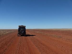
Somewhere in the middle of nowhere on a typical dirt road...

Somewhere in the middle of nowhere on a typical dirt road…

By way of the Waka Road and then the Toona Gate Road we eventually arrived at the intersection with the Silver City Highway. Tibooburra is only 1km north of that intersection. In all we covered 360km today, all on unsurfaced roads. We very nearly had a close encounter with a young bullock at one point when he decided to run across the road in front of us, fortunately the Land Rover brakes still work OK !

The Silver City Highway brings back a lot of good memories from the Outback Challenge competition as it is the main route into Broken Hill from where most of the competition areas were. It also has the main fuel stop that we used outside Broken Hill – the Packsaddle Roadhouse which, as well as providing fuel, was a good chance for competitors to grab a bite to eat.

So, tomorrow we’ll head towards Broken Hill, stopping along the way at some of our favourite Outback Challenge landmarks along the way. It’s also our wedding anniversary tomorrow and in 2008 on the 23rd May we were competing in the Outback Challenge at Denian and Pam spent part of the day running up and down sand dunes with a ground anchor and winch rope – who says romance is dead !

Innaminka

imageMal and his group arrived late yesterday afternoon at Birdsville. We’d spent the day at the camp site waiting for news from him and by the time it got to about 5pm we’d decided to head to the pub. As we crossed the empty lot opposite the pub a motorbike appeared, heading in on the road from Big Red. Before long more appeared and we figured from the colours of the bikes, the number and the timing that it had to be them.
It sounds like they had a much tougher time in the crossing than we did with a few minor injuries, some lost kit and one of the bikes had to be left in the desert with a fried clutch. It’ll be picked up by Mount Dare and the rider got a lift with a passing 4×4 to Birdsville.
Anyway, after they’d all showered, changed and sorted themselves out we had a great evening swapping tales of daring do over a meal and a plentiful supply of alcohol.

An impromptu line up of Land Rovers in Birdsville

An impromptu line up of Land Rovers in Birdsville

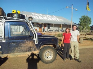
This morning we started the day early with breakfast at the Birdsville Bakery. Though we’ve kind of been putting it off we couldn’t on our last day, miss out on trying their famous curried camel pie. Not my usual breakfast fayre but it was actually pretty good ! We may not have seen any camels in the outback but at least now we can say we’ve eaten one ๐Ÿ™‚
Yesterday a group of Land Rover owners had turned up at the camp site and we’d had a quick chat with most of them. There was even a 101 and a Lightweight in their group (types of Land. Rover, for the initiated). This morning as we were filling up we met up again and they’d also picked up a very nice Perentie (6×6 Australian military Land Rover) camper conversion that looked the business. A quick photo line up was arranged before we headed our separate ways. They were heading for the Hay River track and we headed east on the Birdsville Development track before heading South on the Cordillo Downs Road.

Last call at the bakery for curried camel pies !

Last call at the bakery for curried camel pies !

We covered 422km today, again on unsealed roads apart from a few short stretches of sealed road. On the whole the road wasn’t too bad though with only a few areas that had washouts and corrugations to contend with. We managed to average 70kph over the day so it was pretty good going compared to some roads we’ve been on recently.
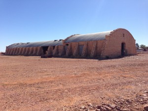
We stopped off along the route at the Cordillo Downs Homestead where they have “Australia’s biggest shearing shed”. In it’s time they hand sheared 82000 sheep in a week in the shed with 120 stations (I think that’s what the info board said !). They had to change from sheep to cattle in the 1920’s when the Dingo population was killing off all the lambs despite a massive cull of the Dingos and a bounty on each one. Nowadays it’s looking a bit sorry for itself but the homestead allow public access to it as part of the heritage of the area.

Australia's biggest shearing shed

Australia’s biggest shearing shed

We arrived at Innaminka sometime after 3pm and have set up camp on “The Town Common” which has a couple of drop toilets and allows camping on it for a small donation in the honesty box of $5. It just so happens that there is a pub within walking distance but, sadly, no phone coverage so I’ll have to post this when we find a phone signal.
Tomorrow we’ll probably head to Cameron Corner unless we decide to head into the Flinders which currently we’re not intending to do but tomorrow we can still change our minds…

Sometimes when you're driving these roads you start to feel very insignificant !

Sometimes when you’re driving these roads you start to feel very insignificant !

Bedourie

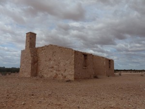
Cacoory Homestead, abandoned in 1906

Cacoory Homestead, abandoned in 1906

It’s strange but after all this time sleeping in the roof tent you’d think that a motel room would seem like luxury. Strangely though we both said this morning that we missed sleeping in the tent and would be glad to be back in it !
Anyway, after checking out this morning our first port of call was the Birdsville Bakery for breakfast. There is a real danger that between the bakery during the day and the hotel at night we’ll both be putting back on all the weight we’ve lost.
We topped off the main fuel tank, giving us our first opportunity to find out how much fuel we used crossing the desert as the fuel gauge is stuck on full at the moment. As it turns out we used 75 litres for the crossing which equates to 19.73 MPG or 14.32 litres per 100km. That is a lot less fuel used than we’d expected for the crossing as most of the “experts” reckon on a lot more fuel being needed.
Our plan after the bakery was to head to Bedourie where we’d spend the night before heading back to Birdsville tomorrow. The road to Bedourie was good with very little in the way of corrugations and some bitumen sections as well as gravel. As a result we covered the 190km in 3 hours with stops, arriving at around 1pm.
Bedourie is a strange place and on arriving it soon became apparent that the town is closed on a Sunday. The information centre where you pay for camping and get the key to see the “free” artesian spa and pool is closed on Sunday so there really wasn’t much to do or see. As a result we decided to head back to Birdsville !
At least on the way back we stopped at a few of the interesting spots we’d seen on the way there such as the abandoned Cacoory homestead. Built in 1877 the ruins of the homestead are a bit of a testament to the reality of living in this area. The homestead was abandoned in 1906 after years of drought and the cattle dying off as a result.

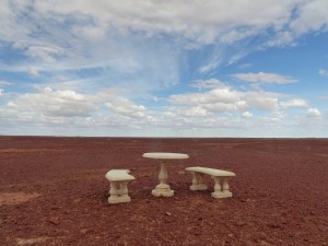
Monumental table and chairs, positioned in the middle of nowhere

Monumental table and chairs, positioned in the middle of nowhere

Travelling the roads of Australia we’ve come across some strange sites at the road side. Some of them are simply surreal or comedic and others you suspect must be used as a signpost to enable people to identify the correct turning to a particular homestead. The first category includes things like the various bottle trees and termite mounds dressed in T shirts, hats, dresses, and hard hats etc…
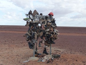
The second category can be even more surreal and you can imagine how much easier it is to give someone phone directions when you tell them to turn at the mailbox that looks like a mouse or the mailbox made from an old fridge. Today’s examples include a stone garden chair and table set and a Private Road sign adorned with hundreds of pairs of shoes…

A signpost adorned with pairs of shoes... And a hat

A signpost adorned with pairs of shoes… And a hat

Sadly, if we stopped and photographed every incident of this kind of bizarre roadside adornment we’d get nowhere but as we had a bit of time to spare today it seemed like a good opportunity to snap these not untypical examples of surreal roadside markers.
Tomorrow will be a day off and I’ll potter about underneath the Land Rover but mostly just chill and read a book. We’re now staying at the Birdsville Caravan Park and will be here for at least 2 nights depending on when Mal and his group arrive.