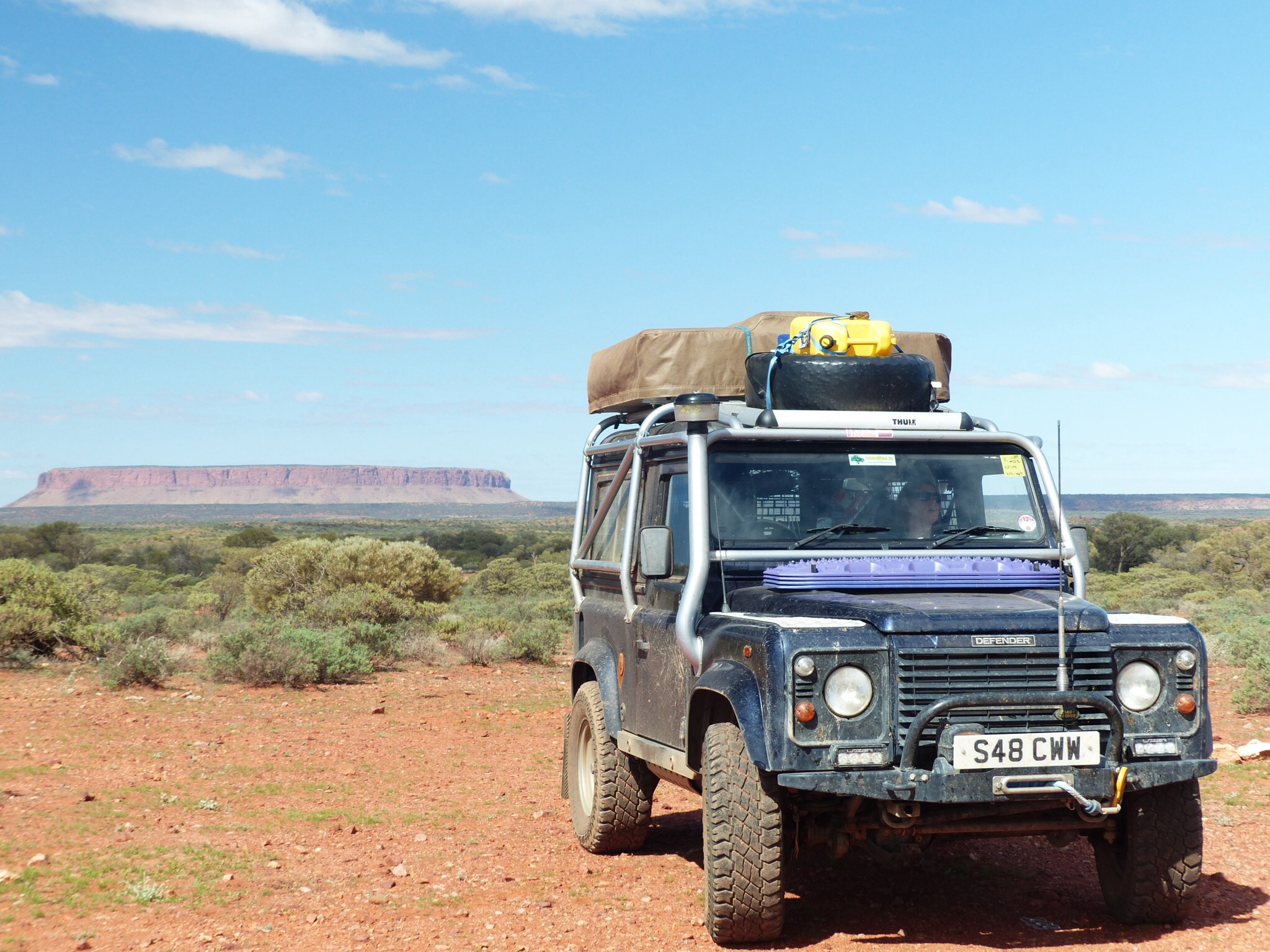
Mount Connor
A bit of a slow news day today as we started one of the more challenging legs of our journey.
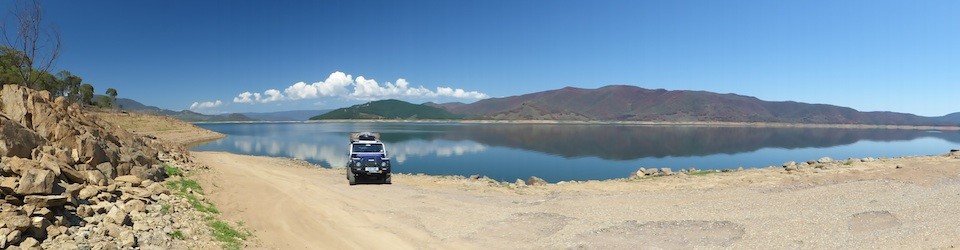
After a brief refill stop at the Yulara resort IGA supermarket we headed east on the Lasseter Highway towards the Stuart Highway. The only diversion of the day was a small off piste adventure to see if the tracks marked on one of the maps actually gave access to Mount Connor or not.
The first unsealed track off the highway to Mount Connor was promising enough and gave excellent views of the mountain as we headed along it. Unfortunately the track we then needed to follow to take us to the south of Mount Connor had no entry signs up, similar to ones we’d seen previously with private property signs. We persevered along the gazetted track for another 12k to a second track but this was indistinct on the ground so we decided to abandon our attempt to get closer to Mount Connor and retraced our route back to the highway.
As we neared the Stuart Highway again there was a definite change in landscape as the dense bush opened out into a sparser, flatter, desert like landscape.
At the junction of the Lasseter Highway and the Stuart Highway is the Erldunda roadhouse and we checked in to the camp site there for the night. With our camp set up we then had to make a decision on our route for the next week or so. After some debate we settled on the simplest option, head for Mount Dare via the most obvious route,
Tomorrow we’ll stop at Marla, another roadhouse on the Stuart Highway. That will be the last we’ll see of sealed roads for at least a week. We’ll then set off to Oodnadatta, along the Oodnadatta track where we’ll spend the night and get our desert parks permit. We’ll then head north to Dalhousie where we’ll spend a night. The next step will be to Mount Dare where we will spend the night after sorting out a sand flag. From Mount Dare, after refuelling there we’ll then head back through Dalhousie to the start of the Simpson Desert crossing, stopping for the first night at Purni Bore.
To cross the Simpson we will follow the French Line to Poeppel Corner where we’ll change to the QAA Line to take us into Birdsville. We’re anticipating a 3 or 4 day crossing which covers around 500km without fuel between Mount Dare and Birdsville but we won’t know until we get there. After Purni Bore we will be camping just off the track each night, stopping when we’ve had enough for the day.
It is unlikely we will have any mobile phone or internet access from the time we leave. Marla to our arrival at Birdsville, meaning it will likely be 7 days at least we’ll be “off the grid” as far as Facebook and blog updates are concerned. I should be able to post another blog entry tomorrow night from Marla though if the Telstra coverage map is correct. I’ve put the scheduled stops and dates on the map page, all subject to change as all the best plans are !