Monthly Archives: May 2014

Innaminka

imageMal and his group arrived late yesterday afternoon at Birdsville. We’d spent the day at the camp site waiting for news from him and by the time it got to about 5pm we’d decided to head to the pub. As we crossed the empty lot opposite the pub a motorbike appeared, heading in on the road from Big Red. Before long more appeared and we figured from the colours of the bikes, the number and the timing that it had to be them.
It sounds like they had a much tougher time in the crossing than we did with a few minor injuries, some lost kit and one of the bikes had to be left in the desert with a fried clutch. It’ll be picked up by Mount Dare and the rider got a lift with a passing 4×4 to Birdsville.
Anyway, after they’d all showered, changed and sorted themselves out we had a great evening swapping tales of daring do over a meal and a plentiful supply of alcohol.

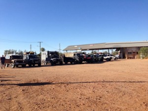
An impromptu line up of Land Rovers in Birdsville

An impromptu line up of Land Rovers in Birdsville

This morning we started the day early with breakfast at the Birdsville Bakery. Though we’ve kind of been putting it off we couldn’t on our last day, miss out on trying their famous curried camel pie. Not my usual breakfast fayre but it was actually pretty good ! We may not have seen any camels in the outback but at least now we can say we’ve eaten one 🙂
Yesterday a group of Land Rover owners had turned up at the camp site and we’d had a quick chat with most of them. There was even a 101 and a Lightweight in their group (types of Land. Rover, for the initiated). This morning as we were filling up we met up again and they’d also picked up a very nice Perentie (6×6 Australian military Land Rover) camper conversion that looked the business. A quick photo line up was arranged before we headed our separate ways. They were heading for the Hay River track and we headed east on the Birdsville Development track before heading South on the Cordillo Downs Road.

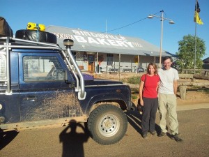
Last call at the bakery for curried camel pies !

Last call at the bakery for curried camel pies !

We covered 422km today, again on unsealed roads apart from a few short stretches of sealed road. On the whole the road wasn’t too bad though with only a few areas that had washouts and corrugations to contend with. We managed to average 70kph over the day so it was pretty good going compared to some roads we’ve been on recently.
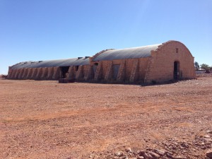
We stopped off along the route at the Cordillo Downs Homestead where they have “Australia’s biggest shearing shed”. In it’s time they hand sheared 82000 sheep in a week in the shed with 120 stations (I think that’s what the info board said !). They had to change from sheep to cattle in the 1920’s when the Dingo population was killing off all the lambs despite a massive cull of the Dingos and a bounty on each one. Nowadays it’s looking a bit sorry for itself but the homestead allow public access to it as part of the heritage of the area.

Australia's biggest shearing shed

Australia’s biggest shearing shed

We arrived at Innaminka sometime after 3pm and have set up camp on “The Town Common” which has a couple of drop toilets and allows camping on it for a small donation in the honesty box of $5. It just so happens that there is a pub within walking distance but, sadly, no phone coverage so I’ll have to post this when we find a phone signal.
Tomorrow we’ll probably head to Cameron Corner unless we decide to head into the Flinders which currently we’re not intending to do but tomorrow we can still change our minds…

Sometimes when you're driving these roads you start to feel very insignificant !

Sometimes when you’re driving these roads you start to feel very insignificant !

Bedourie

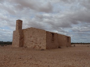
Cacoory Homestead, abandoned in 1906

Cacoory Homestead, abandoned in 1906

It’s strange but after all this time sleeping in the roof tent you’d think that a motel room would seem like luxury. Strangely though we both said this morning that we missed sleeping in the tent and would be glad to be back in it !
Anyway, after checking out this morning our first port of call was the Birdsville Bakery for breakfast. There is a real danger that between the bakery during the day and the hotel at night we’ll both be putting back on all the weight we’ve lost.
We topped off the main fuel tank, giving us our first opportunity to find out how much fuel we used crossing the desert as the fuel gauge is stuck on full at the moment. As it turns out we used 75 litres for the crossing which equates to 19.73 MPG or 14.32 litres per 100km. That is a lot less fuel used than we’d expected for the crossing as most of the “experts” reckon on a lot more fuel being needed.
Our plan after the bakery was to head to Bedourie where we’d spend the night before heading back to Birdsville tomorrow. The road to Bedourie was good with very little in the way of corrugations and some bitumen sections as well as gravel. As a result we covered the 190km in 3 hours with stops, arriving at around 1pm.
Bedourie is a strange place and on arriving it soon became apparent that the town is closed on a Sunday. The information centre where you pay for camping and get the key to see the “free” artesian spa and pool is closed on Sunday so there really wasn’t much to do or see. As a result we decided to head back to Birdsville !
At least on the way back we stopped at a few of the interesting spots we’d seen on the way there such as the abandoned Cacoory homestead. Built in 1877 the ruins of the homestead are a bit of a testament to the reality of living in this area. The homestead was abandoned in 1906 after years of drought and the cattle dying off as a result.

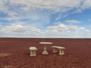
Monumental table and chairs, positioned in the middle of nowhere

Monumental table and chairs, positioned in the middle of nowhere

Travelling the roads of Australia we’ve come across some strange sites at the road side. Some of them are simply surreal or comedic and others you suspect must be used as a signpost to enable people to identify the correct turning to a particular homestead. The first category includes things like the various bottle trees and termite mounds dressed in T shirts, hats, dresses, and hard hats etc…
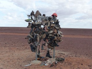
The second category can be even more surreal and you can imagine how much easier it is to give someone phone directions when you tell them to turn at the mailbox that looks like a mouse or the mailbox made from an old fridge. Today’s examples include a stone garden chair and table set and a Private Road sign adorned with hundreds of pairs of shoes…

A signpost adorned with pairs of shoes... And a hat

A signpost adorned with pairs of shoes… And a hat

Sadly, if we stopped and photographed every incident of this kind of bizarre roadside adornment we’d get nowhere but as we had a bit of time to spare today it seemed like a good opportunity to snap these not untypical examples of surreal roadside markers.
Tomorrow will be a day off and I’ll potter about underneath the Land Rover but mostly just chill and read a book. We’re now staying at the Birdsville Caravan Park and will be here for at least 2 nights depending on when Mal and his group arrive.

Birdsville

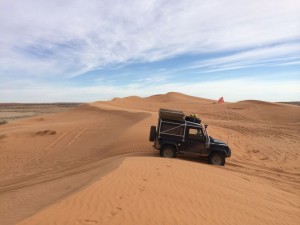
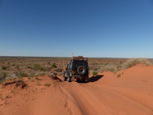
At the crest of "Big Red"

At the crest of “Big Red”

Our anti-fly strategy wasn’t as effective this morning, I think the flies must have figured it out and they were up and about before sunrise which was a bit unsporting of them. Anyway, we coped and got everything done we needed to get done !

It was a bit overcast first thing so we didn’t wait for the sun to get quite as high before setting off for our final challenge of the crossing “Big Red”. I lowered the tyre pressures a bit last night (they were already pretty low but wanted to give ourselves every chance) and with Big Red only a couple of kilometres from our overnight stop the tyres were still nice and cool when we got there. (See video clip at the bottom of this post)

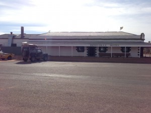
The Birdsville Hotel

The Birdsville Hotel

As it was we got up it first time so we didn’t have to take the diversionary track which was a bonus 🙂 I stopped as soon as we were over the crest so we could take a picture from outside the vehicle of this land mark in our journey.

After Big Red the track headed across yet another salt lake before bearing right. After that the road got better and better until we were on the graded road all the way into Birdsville. As we have arrived 3 days before Mal is due to arrive we’ve decided to treat ourselves to a night of relative luxury, staying in a motel room at the Birdsville Hotel for the night.

We’ll go off on a little side tour for the next couple of days and take in a few of the local sites before heading back to Birdsville for the 20th when Mal is due to arrive.

http://youtu.be/1ClwH8hN3D4


Simpson Desert Day 3

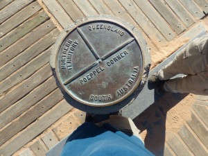
Marker at Poeppel Corner

Marker at Poeppel Corner

Following our anti-fly tactic we were up early again this morning in time to watch the sunrise. As soon as the sun was high enough to safely drive east we set off.
There were lots of Dingo tracks along the wheel tracks this morning and, again, we saw one of them heading off into the bush not long after we set off.
Our first stop was at Poeppel Corner where we did all the usual stuff – standing in 3 states at the same time etc… Before heading north to meet the QAA Line to head east.

One of the salt lake crossings

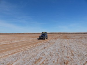
One of the salt lake crossings

The pattern of dunes continued form yesteday, gradually becoming bigger with more space between them. Although the dunes were generally harder to get up the spaces between were smoother, allowing us to cross them much faster. There were occasional humps that caught us out and a lot more corrugated sections.
We covered 159km today at an average speed of 29 km per hour and are now camped about 2km short of “Big Red” which is the largest of the dunes on the crossing. (25.88079°S, 139.03641°E)

Sunset over the desert

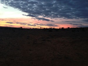
Sunset over the desert

Tomorrow we’ll head into Birdsville where we should finally have a phone signal again and internet access so I can post the last few blog entries. We’ll stay there for a couple of nights until Mal arrives (he’s following the same route across but on a motorbike).

Simpson Desert Day 2

Sunrise at our camp site

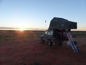
Sunrise at our camp site

As a strategy to avoid the flies, or at least minimise their nuisance, we got up early this morning. The flies don’t become active until some time after sunrise so getting up before sunrise means you can get washed, make a brew and have breakfast without their constant attention.
Once we’d got everything sorted we then retired to the sanctuary of the tent until the sun was high enough that we could drive and be able to see – we’re more or less heading due east at the moment so the sun has to be a way above the horizon before we can comfortably drive anywhere.
We covered 129 km today at an average of 22 km per hour. The dunes started to spread out a bit as we got further east with the relatively flat stretches between them getting longer. Unfortunately the humps between the dunes make any sort of speed a risk as they are difficult to spot and judge in the sand. Every time I thought I could speed up a bit another sequence of humps would throw the Land Rover in the air with most of the contents of the rear landing again a second or so after the Land Rover. In the worst cases you’d hit the face of the next hump as you landed. Travelling at a modest 30 km per hour normally gave enough time to slow down enough to ride the humps comfortably.
The dunes themselves, of which there are 1100 along the route, are mostly pretty easy to climb and descend. Every now and again we hit a steeper one or one where the sand was a bit softer and I’d have to back up and take another go at it with the rear locker engaged. There are also alternative routes on most of the more challenging dunes which may or may not be easier than the direct approach.

A Dingo early in the morning

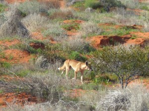
A Dingo early in the morning

A lot of the time I was running without diff lock as it was unnecessary and that caught me out a few times as an innocuous looking dune would stop us in our tracks and I’d have to back up, engage diff lock and go again. I think, today, we probably had to have a second go at 3 or 4 of the dunes, mostly due to complacency on my part 🙂 At a very rough guess based on the distance travelled and the number of dunes along the route we probably crested the best part of 400 dunes today.
Along the route there are hundreds of small lizards that run across or along the track as we approach. They almost seem to glide over the sand with their tails high in the air. We saw what we think we’re camel tracks in places and a couple of broken emu eggs that had, presumably, been eaten by predators. The star wildlife of the day was either the Willy Wagtail (that’s it’s proper name, look it up) that was doing it’s best to catch the flies on our tent this morning or the Dingo that we saw crossing our track and heading off into the bush. The Dingo is only the second we’ve seen on this trip so far and this particular one looked much healthier and bigger than the first.

The distance between dunes is starting to increase

The distance between dunes is starting to increase

Once again we’ve pulled over at the side of the French Line, even further from civilisation than yesterday. No mosquitoes again, which is a real bonus so once the flies disperse after sunset it’s pleasant to sit outside and enjoy the peace and quiet. We’re camped about 22km from Poeppel Corner (26.02257°S, 137.77324°E) tonight and, since pulling over at 3pm, we’ve seen one vehicle go past, heading west. Today we’ve seen 5 groups or single vehicles heading west.
Tomorrow we’ll do the early start thing again as per this morning and head to Poeppel Corner where the French Line ends. From there we take a jink north into the Northern Territories for about 18km before turning east and heading into Queensland on the QAA Line. (Poeppel Corner marks the place where the three states meet (South Australia, Northern Territories and Queensland)

Simpson Desert Day 1

Dalhousie Springs

Dalhousie Springs

We managed to get away from Mount Dare in good time this morning after topping off both fuel tanks and filling the 20 litre jerry can as insurance. We’ve gone over the consumption figures time and time again now and think we’ve comfortably got enough fuel to make it – I think we could almost make it on just the main tank and jerry can leaving us 60 litres in hand.
We retraced 60km of our route from yesterday back to Dalhousie first thing before turning to Dalhousie Springs for our first stop. The road hadn’t got any better overnight but at least I knew what to expect !
The springs are a natural hot water spring that have created a small lake. The water temperature of the lake is around 36 degrees C so about the same temperature as a warm bath. I had expected the water to smell of sulphur or similar but it seemed odourless. If we’d camped overnight at the springs I’d have been tempted to take a dip !
At Dalhousie Springs there was a notice that the Purni Bore camp site is closed for building work. That was our intended camp site for tonight but we decided with that closed we’d just push on into the desert.

Proper Desert at last !

Proper Desert at last !

The road to Purni Bore was badly corrugated and by the time we got that far we were getting a bit fed up of the constant vibration. From Purni Bore though we started to get into the real desert with sand becoming more predominant than clay and rock. This meant that the corrugations gradually diminished and we just had the soft sand and dunes to contend with.
The first part if the French Line is shared with the other routes that cross the desert. All in all it was pretty easy going with a bit of a rhythm to it as you crested each sand dune, a short flat section then onto the crest of the next dune. None of the established route gave us any issues in high box without diff lock although I did have an experiment on one of the dunes that had been bypassed slightly to see how the Land Rover would behave on the tyre pressures I’d selected. The first two attempts without diff lock failed just short at the crest but with diff lock in it pulled over the crest with little effort on the third attempt so it seems the tyre pressures are somewhere in the right ball park.

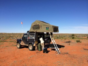
Our fist night camping in the Simpson Desert

Our fist night camping in the Simpson Desert

After the first junction on the track, where the various crossing routes diverge, the track changes character yet again. The French Line becomes a very narrow single track and even in the Land Rover with it’s narrow body we were brushing the bush on either side. The track also develops “humps” which are fairly widely spaced and give the suspension a real workout while limiting the speed you can travel at. A lot of the time we were limited to speeds below 20kph by the humps.
Where we pulled off the track and set up camp tonight (26.20018°S, 136.52490°E) we have covered around 175km of the 500km distance to Birdsville from Mount Dare. We have another 160km of the French Line to cover before Poeppel Corner where we head into Queensland on the QAA track. The French Line is the hardest of the tracks so we’ll take it steady again tomorrow and see how far we get.
It’s great to be able to just pull over anywhere you want and set up camp in the middle of nowhere. Sat here, at least 175km away from any form of civilisation, there’s a real feeling of peace and tranquility. That’s one of the things we’ve both been waiting for I think on this trip. No Mosquitos here so once the sun went down and the really annoying flies departed it turned into a really pleasant evening. There’s a full moon so the stars aren’t bright yet which is a bit of a shame as nothing beats a cloudless night sky in the desert.

Mount Dare

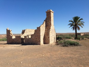
Ruins at Dalhousie

Ruins at Dalhousie

A slight change of plan today as we got to Dalhousie at dinner time and decided we may as well keep going for the extra 55 km to Mount Dare.
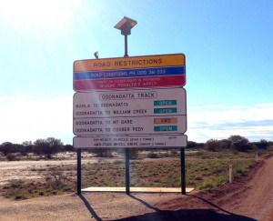
The first part of the route, from Oodnadatta to Hamilton Station was a bit rougher than the Oodnadatta track had been yesterday but we still made good progress along the 100 km stretch. After Hamilton Station the track was pretty bad, having more corrugations and washouts. The final part, from Dalhousie to Mount Dare, was a lot rougher with bad corrugations and some major washouts. It was clear that the track gets flooded on a regular basis and there has been some recent flooding with big ruts in the track.

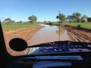
The track at Mount Dare

The track at Mount Dare

As we approached the Mount Dare hotel the track was completely submerged with signs showing an alternate route to bypass what was basically a large pond where the track had been. We had to drive through the last part of the water but it wasn’t deep.
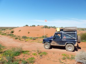
We booked in for the night, bought a sand flag and our desert parks permit and ordered food for later on. (Steak and chips again !). The sand flag was going to be a bit more difficult to attach than I’d hoped but the Mount Dare staff drilled a hole in the winch bumper for me to help secure it so it should be OK. The flag itself is 3 metres high so mounted on the winch bumper it meets the required 3.5 metres from the ground requirement.
Sand flags are mandatory in the Simpson Desert, the idea is that having a tall flag on the vehicle should warn oncoming traffic of your presence, particular when approaching the blind crest of a sand dune.

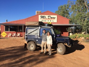
Mount Dare Hotel

Mount Dare Hotel

We did consider staying here for two nights to keep to our schedule but in the end decided we’d crack on tomorrow and take our time in the crossing. If we arrive at Birdsville a day earlier than planned then we’ll stay an extra night there.
The meal at the hotel was excellent and we had an enjoyable evening chatting to the owners and staff and a group who are also crossing to Birdsville, setting out tomorrow.

Oodnadatta

Oodnadatta TrackWe’ve planned this part of the journey as a series of relatively short hops. The main reason for this is the unpredictability of the unsurfaced roads we’re using.
The trip from Marla to Oodnadata, along the Oodnadatta Track is only about 210 km. The road was mostly in pretty good condition. Patches of corrugations were few and far between and the only hazards were the occasional water holes where the road has been damaged when it’s been driven in the wet.
There are cattle grids along the road too and these had to be treated with respect as the steel plates tend to sit above the road surface. Hitting them at any speed and you can really feel the impact, they could probably slice a tyre if you were unlucky.
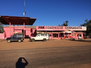
Other than the hazards above we could easily cover the ground at 80 to 90 kph so we arrived in Oodnadatta shortly after dinner time. Our first stop was the Pink Roadhouse to pay for camping and get our desert parks permit. The camping was easily sorted but it seems that, contrary to the government web site, they no longer sell the permits. We’ll have to see if we can get one at Mount Dare.

The Pink Roadhouse

The Pink Roadhouse

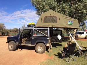
The camp site isn’t exactly the best we’ve stayed at but it’s functional ! We’ve had a few nights with broken sleep thanks to noise on the camp sites and we were both pretty tired when we arrived so we had a bit of an afternoon kip in the tent both to catch up on some sleep and to evade the numerous flies that were driving us to distraction !
Tomorrow we’ll head north to Dalhousie, another short trip of around 200km. We might continue to Mount Dare if the road is good and we get there in decent time.

Marla

imageAs planned, a short 250km hop south to Marla today along the Stuart Highway.
Arriving early, around 1pm, gave me a chance to give the Land Rover a look over and tend to a few outstanding jobs. Other than one of the bolts on a rear trailing arm being a little loose all seems fine. I tightened the bolt up on the trailing arm and also nipped up the adjustment on the auxiliary tank filler cap that has been weeping slightly.
Before we hit any deep sand or dunes I’ll probably disconnect the low range sensor on the gearbox as the way the engine ECU reduces the engine power and throttle response at low revs makes driving it quite hard work, especially when I’m more used to driving a big V8 in sand.
Our planned route for the next week, as outlined in yesterday’s post still stands. It’ll be at least 10 days before we drive on bitumen again by which time I suspect we’ll be glad of a smooth, predictable road surface !

Erldunda

Mount Connor

Mount Connor

A bit of a slow news day today as we started one of the more challenging legs of our journey.
After a brief refill stop at the Yulara resort IGA supermarket we headed east on the Lasseter Highway towards the Stuart Highway. The only diversion of the day was a small off piste adventure to see if the tracks marked on one of the maps actually gave access to Mount Connor or not.
The first unsealed track off the highway to Mount Connor was promising enough and gave excellent views of the mountain as we headed along it. Unfortunately the track we then needed to follow to take us to the south of Mount Connor had no entry signs up, similar to ones we’d seen previously with private property signs. We persevered along the gazetted track for another 12k to a second track but this was indistinct on the ground so we decided to abandon our attempt to get closer to Mount Connor and retraced our route back to the highway.
As we neared the Stuart Highway again there was a definite change in landscape as the dense bush opened out into a sparser, flatter, desert like landscape.
At the junction of the Lasseter Highway and the Stuart Highway is the Erldunda roadhouse and we checked in to the camp site there for the night. With our camp set up we then had to make a decision on our route for the next week or so. After some debate we settled on the simplest option, head for Mount Dare via the most obvious route,
Tomorrow we’ll stop at Marla, another roadhouse on the Stuart Highway. That will be the last we’ll see of sealed roads for at least a week. We’ll then set off to Oodnadatta, along the Oodnadatta track where we’ll spend the night and get our desert parks permit. We’ll then head north to Dalhousie where we’ll spend a night. The next step will be to Mount Dare where we will spend the night after sorting out a sand flag. From Mount Dare, after refuelling there we’ll then head back through Dalhousie to the start of the Simpson Desert crossing, stopping for the first night at Purni Bore.
To cross the Simpson we will follow the French Line to Poeppel Corner where we’ll change to the QAA Line to take us into Birdsville. We’re anticipating a 3 or 4 day crossing which covers around 500km without fuel between Mount Dare and Birdsville but we won’t know until we get there. After Purni Bore we will be camping just off the track each night, stopping when we’ve had enough for the day.
It is unlikely we will have any mobile phone or internet access from the time we leave. Marla to our arrival at Birdsville, meaning it will likely be 7 days at least we’ll be “off the grid” as far as Facebook and blog updates are concerned. I should be able to post another blog entry tomorrow night from Marla though if the Telstra coverage map is correct. I’ve put the scheduled stops and dates on the map page, all subject to change as all the best plans are !