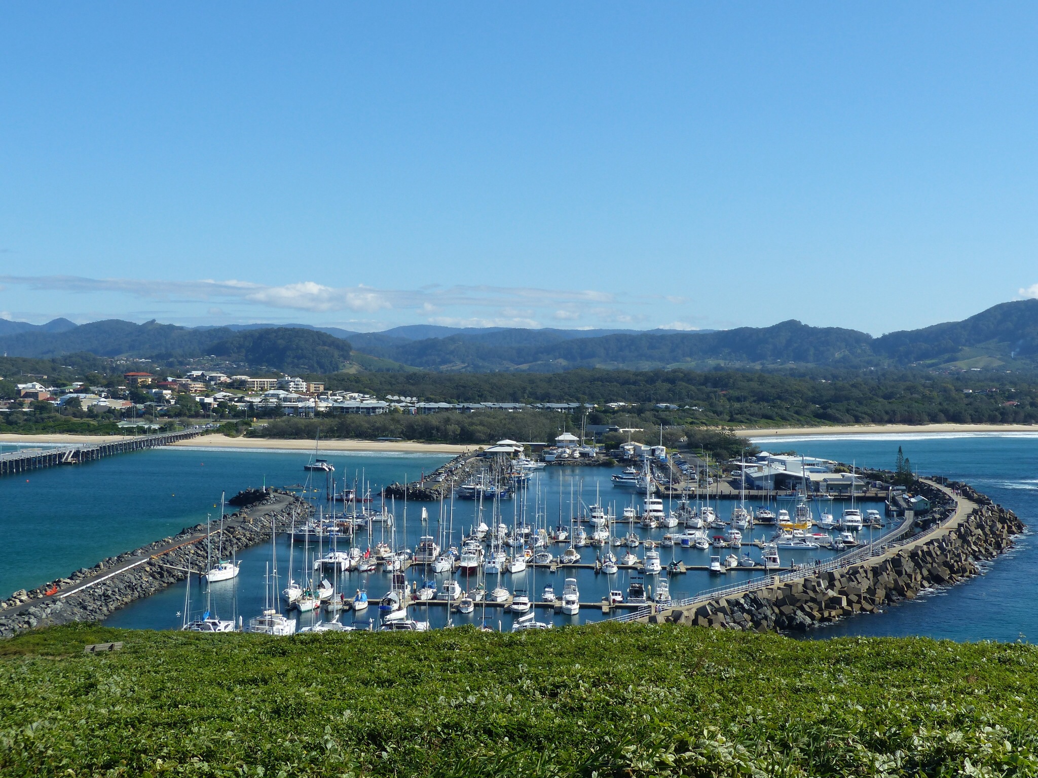
The marina and beaches at Coffs Harbour
Today was when of the rare days on this trip where our plans in the morning are thwarted. In this case by a mixture of mapping errors and road closures.
It all started well enough as we headed for our first destination of the day, Coffs Harbour. It’s one of those places that everyone seems to know, a bit like Byron Bay I guess, so we wanted to take a look while we were passing.
We headed down our old favourite, the Pacific Highway which, once again, delivered it’s now familiar string of roadworks. The only consolation is that at least here the roadworks tend to just result in lower speed limits rather than big traffic queues.
Coffs Harbour is a lot bigger than we’d expected, although most of it is set while back from the coast. It seems packed with shopping areas, industrial estates, tourist attractions and so on but when you eventually make it to the coast all of that seems to disappear. The marina, the beaches and
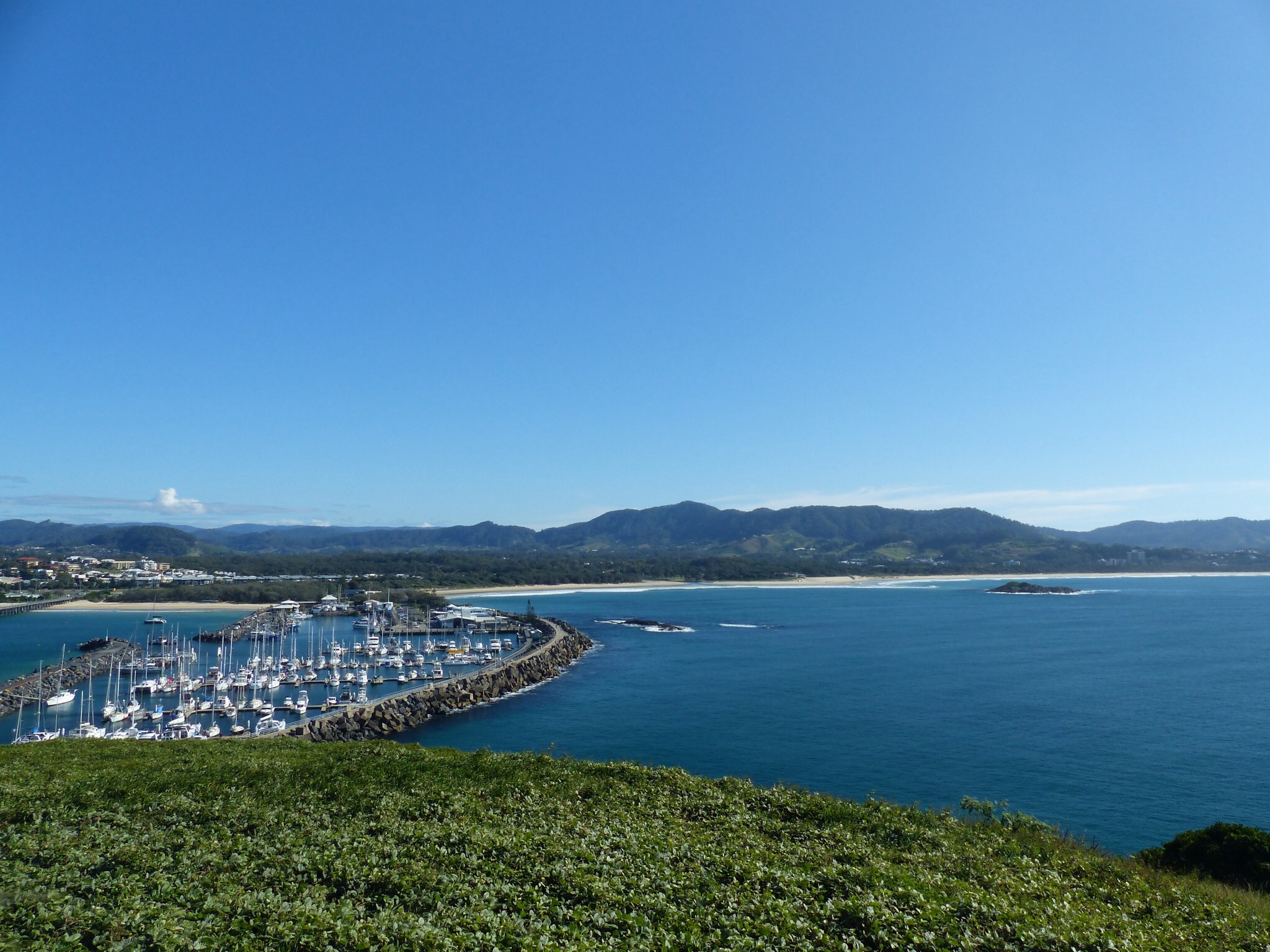
Another view of Coffs Harbour from Muttonbird Island
Muttonbird Island that stands at the entrance to the harbour all seem to make up a small but busy harbour area. From the island you’d never guess at the huge town that is hidden behind the beaches.
After walking up to the top of Muttonbird Island and then selecting our choice of yacht in the marina for when we win the lottery we decide we’d head off towards “The pub with no beer” where we would stay the night.
The first part of the journey was back on the Pacific Highway again until we could turn off to a small town called Bellingen. This is about 20km inland from the highway and would allow us to take the minor gravel roads to Bowraville and then onto The Pub With No Beer.
We had second breakfast in Bellingten (coffee and custard pies) and headed down the minor road to Bowraville. It was shortly after this that our plans went awry as we came to a fork in the road there was a yellow warning sign telling us that there was no access to Bowraville on the left fork that we would have taken. A quick look at the HEMA maps showed that the right fork, though slightly longer would also take us to Bowraville and we assumed that’s why only the left fork had the warning sign.
After about 14km of this part gravel, part tarmac road the road seemed to diverge from the road marked on the map. Where the map showed the road turning south the road actually seemed to follow the course of a river, heading west into the middle of nowhere. We followed the road for another 5km or so in the hope that this was just a minor difference between the map and reality before having to make a decision. Time was starting to be an issue as we didn’t want to end up finding a camp site in the dark or navigating roads that don’t exist on the map.

Camp set up at Nambucca Heads – a bit of a tropical feel under the palm trees
We initially turned back and drove to the point where the road diverged from the map and could find no sign of the road as it was mapped. In the end all we could do really was head all the way back to Bellingen and find somewhere we could get to in the time available.
We selected Nambucca Heads as it was easy to get to on the Pacific Highway and far enough south to make us feel we’d made some progress ! It probably means that we won’t get another chance to head inland again though now.
Tomorrow we’ll probably head to Trial Bay Gaol, sticking to the coast this time !