Category Archives: Australia 2014

Karajini National Park Day 1

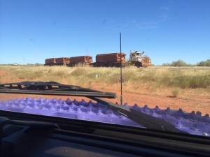
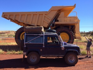
Big Truck, Little Truck

Big Truck, Little Truck

Our first stop today was at the top on Mount Nameless, reached via a steep 4×4 only track not far form the camp site. It seems to be the highest point around and on one side you can see the landscape extending to the curved horizon, on the other side you get a bird’s eye view of the large scale mining operations that seem to be the principal employer and industry in this area.
One of the old mining trucks is set up as a display for the tourist information rest stop so we had another big truck, little truck opportunity 🙂

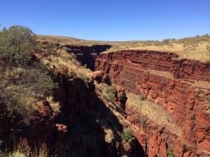
View from the Oxer lookout point at the rim of the gorge

View from the Oxer lookout point at the rim of the gorge

Heading to the national park we chose to go to the Knox Gorge via the unsurfaced 40km road. The signage is a bit confusing at first with lots of potential walking routes from the main parking area. Eventually we figured out which path was which and set off first for the Oxer lookout and then back to the class 2 and class 5 routes that combine to form the route to the Handrail Pool that those coming back out of the gorge were recommending.
We were a bit wary at first about attempting the route as “Class 5” is posted as a “you will die if you get it wrong” kind of route, with class 6 requiring absailing equipment and special permission from the rangers office. In the end we decided to set off down it and turn back if it got too scary.
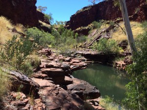
In the end the route wasn’t anywhere near as difficult as the signs indicated. You essentially walk down to the bottom of the gorge using steps cut into the side of it then walk along the bottom of the gorge. There are a few pools of water that you have to wade through but none of them much deeper than thigh level.

The first pool at the bottom of the descent into the gorge

The first pool at the bottom of the descent into the gorge

The last part, the descent into Handrail Pool is the most difficult as the stream cuts through a narrow gap and then drops maybe 30 feet into the Handrail Pool. The stream bed is very slippery but where it starts to drop there is a sturdy hand rail attached to the rock face and basically you cling onto that with both hands as you move forward to the vertical drop. Again you use the handrail, now vertical, to support you while you climb down the steps in the vertical face until you reach the rock outcrop that forms the “beach” for that end of the pool.

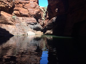
Handrail Pool

Handrail Pool

The big camera’s battery had died so all I had was my iPhone so the pictures here are all taken with the iPhone. It is a magical place, well worth the effort to get to it. Due to the bedding planes of the surrounding rock being tilted slightly from horizontal it creates the illusion of the water in the pool sloping upwards, away from you.
We decided against a swim in the pool as we weren’t really geared up for it and I’m not that strong a swimmer that I’m confident to swim in a deep pool with a difficult exit/entry.
We wound our way back out of the park via the “scenic” route visiting a number of outlooks on the way but we didn’t have time to descend to any of the other pools. Tomorrow we’ll head to see some of the waterfalls we didn’t have time for today and might even go for a swim if there’s a more likely spot.
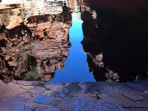
I couldn't resist including this shot - the reflection of the rocks and sky above in the pool and the contrast with the grey rock that forms the edge of the pool.

I couldn’t resist including this shot – the reflection of the rocks and sky above in the pool and the contrast with the grey rock that forms the edge of the pool.

We’ve booked another 2 nights at the camp site here, tomorrow will be spent in the national park and Wednesday will be a chance to catch up on some maintenance jobs and a trip to the supermarket and bottle shop for supplies. The fuel pump has become quite noisy when running from the main tank so I’ll try changing the pre-filter as we may have picked up some bad diesel along the way. The front tank, which has it’s own pre-filter, doesn’t cause the problem so we’ll run off that for the moment. I also think it’s time to change snorkel tops to the ARB cyclone thing as we’re starting to encounter more dust from other vehicles now.

Karajini National Park day 2

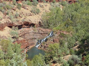
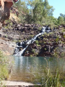
The Fortescue Falls and pool viewed form near the top of the canyon.

The Fortescue Falls and pool viewed form near the top of the canyon.

For today’s foray into the national park we chose to go to the Dales Gorge which at least meant we were on surfaced roads all the way. As we approached the park we saw a large animal that we at first thought was a large fox, crossing the roads in the distance. When we got to the spot the animal was stood just off the road looking back at us and was, in fact, our first Dingo sighting of the trip.
We stopped at the car park above the Fortescue Falls as that seemed to be a spot that is recommended for swimming and today we both wanted to go for a swim if safe/practical.

The Fortescue Falls

The Fortescue Falls

The climb down the side of the gorge was much steeper than yesterday’s climb with very tall steps cut into the rock and the occasional natural rocks that you had to clamber down. As we descended into the gorge you could clearly see the waterfall below and the pool below it which already had a good number of people swimming in it.
Once you’ve finished climbing down the man made steps you end up at the side of the pool, maybe 30 ft above it and then climb down the natural steps to the pool created by a combination of the rock’s natural bedding plains and water erosion.

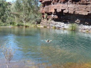
Pam swimming below Fortescue Falls

Pam swimming below Fortescue Falls

The water wasn’t too cold after the initial shock and after the heat of the sun during the descent it was a welcome relief. The rock that wasn’t covered in water was almost too hot to stand on with bare feet ! We swam in the pool for a while and then sat under the waterfall before exiting and drying off in the sun, a very pleasant way to spend a morning 🙂
Circular Pool is about 3km further down the gorge and there is a “class 3” walking trail to it so after we’d dried out a bit we headed off down the gorge. There are a series of pools and waterfalls along the way that all looked tempting but most impressive were the rock formations. All worn smooth by the water when the gorge is in flood. There are also some huge boulders that have been carved away at the bottom, many with tree trunks forced underneath them. It’s not surprising there are warnings to leave the gorge if it starts to rain as the remnants of previous flows are visible about ten feet above us.

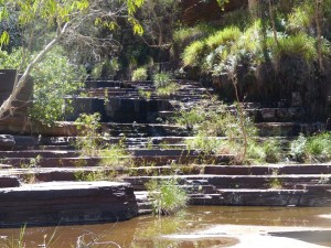
The water steps up to Circular Pool

The water steps up to Circular Pool

Circular Pool was a bit of a disappointment in the end and was a bit of an anti climax after the trek along the gorge. We didn’t stay very long as a result and headed back to the Fortescue Falls along the gorge again.
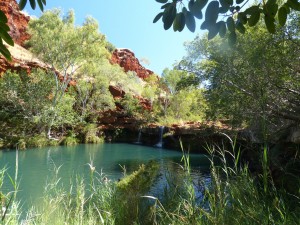
One of the guide books mentioned Fern Pool and we’d not been able to find it on any map or on any of the signs. Once we returned to the falls and started to head up out of the gorge though I spotted a sign for it. As it had been recommended we put off the climb out of the gorge and decided to divert to have a look. It’s only about 500 metres from the falls and, as it turned out, well worth the diversion. It really is an amazing place, even the crowd of Germans shouting to each other across the pool couldn’t destroy the atmosphere of the place. There were some large fruit bats roosting in the trees above the pool, the first we’ve seen on this trip.

Fern Pool, a photograph doesn't do it justice.

Fern Pool, a photograph doesn’t do it justice.

The walk out of the canyon wasn’t as painful as we’d expected and it didn’t seem to take as long as we’d expected, I think we only stopped three times for a drink of water. We’ve come to the conclusion that the water we picked up at Denham is desalinated water as it seems to leave a very slight salty taste behind. It’s OK but tends to leave you feeling slightly thirsty all the time. We’re going to empty that bottle out and refill if with the “town water” here. Glad we have 3 individual water containers rather than 1 large one or they’d all be tainted.
On returning to the camp site at Tom Price we headed to the swimming pool which we had to ourselves, all in all a very energetic day, certainly earned a couple of beers and a glass of red or two…
Tomorrow is still planned as a maintenance and replenishment day. The Gibb River Road looks to be opening in the next day or so and we’re about 3 days away from Broome so if we get the vehicle fettled and get our provisions sorted we’ll be ready to start the next stage of our little adventure with a trip northwards to Broome before turning east and saying goodbye to WA.

Tom Price – maintenance day

Our original plan for today was to catch up on a few maintenance jobs, get some fuel and food and get ready to depart north tomorrow morning.
All that changed when I started the inspection of the underside of the 90 when I found an ATF leak that suggests the the output oil seal of the auto box is failing. I don’t have a spare seal and don’t really have the equipment to change it even if I did. The leak has the potential to disable the vehicle and with no filler/level tube on the gearbox it’s not going to be easy to replenish the lost oil.
There is a distinct scarcity of Land Rover specialists in this part of Australia so finding someone who has experience of the job is going to be difficult. Add to that the Easter holiday and we’re left with a bit of a conundrum. I had a chat with Patrick at Maddison4x4 about it and he suggested a few things to check. Tomorrow I need to find a suitable spot to check the level and figure out, if I can, how serious the leak actually is. If it’s bad we may need to change our plans and dates to get it fixed. In the meantime we’ll carry on and keep an eye on it in the hope that it isn’t going to get much worse… We’ve done at least 1000 miles with it leaking so far so no need to get too concerned yet – it’s a Land Rover, it leaks, live with it !
On the plus side I did get the pre-filter changed on the main tank and that has cured the noisy fuel pump problem when running off that tank. I also tightened up the spare wheel carrier again, finally removing the tatty bit of rubber that used to be a bush from the slider. Not sure what the bush was supposed to achieve but all it seems to have do is slowly disintegrate. I also changed the snorkel top over to the ARB cyclone style that is supposed to help filter out sand particles.
We’ve booked in for an extra night so we can finish off what jobs are left and hopefully have a more relaxing day ! That should allow us to set off to Port Headland with full fuel tanks on Friday, top the off Saturday and be self sufficient in fuel, food etc… until Tuesday.
Assuming the gearbox leak is manageable we’ll try and get a new seal sent to us when we have a suitable stop over address. Once we have a seal I should be able to supervise and or help a general mechanic to do the job if it becomes necessary.

We also met up with Frank Cook today, a fellow “Pom” who is pursuing a similar adventure with his brother. They had the good sense to use a Toyota, for which competent mechanics and spares are available on every street corner by comparison 🙂 Looks like we’ll be heading along the Gibb River Road at about the same time unless either of us have our plans derailed in the meantime.

Tom Price – final day

Had a bit of a bad day today, again. It seems that our “rest day” isn’t to be ! After yesterday’s drama with the gearbox leak we had a plan to fill up the fuel tanks, get some food, check the gearbox oil level and then chill out for the rest of the day.
Step 1, filling up the fuel tanks, turned the whole day upside down as diesel started pouring out of the top of the main tank and all over the forecourt. The sender unit seal has failed after splitting and it looks like my attempt yesterday to tighten up the locking ring has made it much worse, turning a minor leak into a major torrent.
We bought a plastic jerry can from the fuel station while making use of their emergency spill kit and pumped fuel out of the tank into that while trying to stem the flow. With the fuel lost on the forecourt and 20+ litres in the jerry can the level dropped below the sender fitting and I could take the sender out. The rubber seal has spilt near the top so no straight forward fix. By rotating the seal I think the situation is better and we bought some SikaFlex form the hardware store and added that as a secondary seal. Adding the jerry can fuel back to the main tank revealed a minor leak but nothing of the scale we’d experienced previously. I then added yet more SikaFlex around the outside of the assembly to try and reduce it further. Only time will tell if we’ve succeeded.
We did get the rest of our jobs for the day done and managed to get a couple of hours of chilling out including a swim in the pool at the camp site.
The good news is that the auto box oil level is fine so we’re going to carry on and monitor it. The fuel leak, if it still exists, is more of an inconvenience as it means we’ll need to carry a jerry can to maintain fuel capacity.
Tomorrow we’re going to hit the road again and head to Port Headland, probably stopping for the night at a rest area on the way. As of today it looks like the Gibb River Road is now open along it’s entire length so we’ll continue to that and take stock prior to committing.

De Grey River

Iron ore road train heading north to Port Hedland

Iron ore road train heading north to Port Hedland

Finally back on the road today with a 500k trip up to Port Hedland then east on the road to Broome.
The first part of the road north took us through the Karajini National Park again and through some outstanding natural landscapes. As we left the park the scenery changed completely from rugged outcrops forming large hills to a large plains area.
Traffic on the road to Port Hedland seemed to be made up primarily of road trains either moving ore north or coming back empty to the south. There seemed to be, literally, hundreds of road trains operating between the numerous mines and Port Hedland, each pulling 4 trailers or 3 trailers with 4 ore skips. There are also numerous mining industry utes that seem to run up and down the road on one mission or another. It kind of reminded me of a trail of ants with the road trains busily moving goods back and forth while the fleet of little white utes buzzed about them like the soldier ants, ready to respond to any form of hitch or breakdown.
We didn’t stop at Port Hedland as it all seemed very industrial with new roads and rail terminals seemingly being built to support the mining industries’ needs. Instead we continued east to our preferred stopping point for the night.

A pleasant spot near the river at the rest stop. Free camping with a council provided free WiFi hotspot.

A pleasant spot near the river at the rest stop. Free camping with a council provided free WiFi hotspot.

We’ve stopped at a free camp spot at the side of the De Grey River. Telstra reception is sporadic so this might not get posted until tomorrow or it might not have any pics until tomorrow. The local council have paid for free WiFi access at the camp site but we’re camped a bit far away from the hotspot to make use of it. The site is really nice though and there are a few people here who are staying for the whole weekend it would seem.
Tomorrow we’ll continue on towards Broome, not sure yet if we’re going to stop along the way or just go for it to get there. Broome and then Derby are really just somewhere we need to go to get to the Gibb River Road so how much time we spend on little diversions along the way I’m not sure. Broome is only 500k away now and we did that today quite comfortably but the dilemma is always, do we want to zip through somewhere or should we take our time to discover the hidden gems that the area may offer.

Barn Hill Station

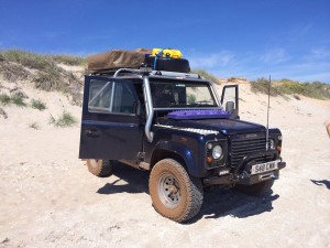
Parked on 80 mile. Beach

Parked on 80 mile. Beach

We moved a bit closer to Broome today after a relaxing night at the rest area. It’s often the case that the rest areas seem to be quieter at night than the paid for sites.
We stopped off at the first roadhouse we came to and topped both fuel tanks off with some trepidation after what happened last time… No drama this time thankfully and we left the forecourt dry.
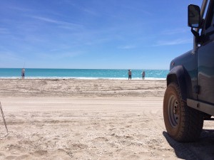
Anyway, first diversion was to 80 mile beach which, as the name might suggest, is quite a long stretch of beach. We took a look at the camp site there but it looked crowded and it was too early in the day really to think about setting up camp. Instead we drove down onto the beach and parked up, deploying the side tarpaulin for a bit of shade. We spent a couple of hours there watching the world go by, it seems to be a bit of a Mecca for fishing.

The colour of the ocean on the west coast never gets old...

The colour of the ocean on the west coast never gets old…

Continuing towards Broome we stopped off at the roadhouse we’d originally considered for an overnight stop but there was little/no shade there and with the temperature pushing 38C we didn’t fancy that in the heat of the afternoon so chose to continue for the remaining 200+ km to the Barn Hill Station camp site.
It’s not the most interesting road, to say the least, and seems to continue forever with very little change in landscape or even any bends to speak of and hardly any traffic. At around 30k from the camp site we came across a saloon car sat on the verge and the occupants waved us down. They’d had a front tyre blow out and had a spare tyre but no jack.
We carry a bottle jack and a Hi-Lift jack and with the car sat on the wheel rim there was no way we could get the bottle jack under without lifting the car first so we suggested flagging down another car in the hope that they had a smaller jack that was easier to get to.
When you consider how little traffic there was on the road and that we’d not seen more than 3 or 4 Defenders since Perth, it was more than a bit of a coincidence that the next vehicle to come down the road was another Defender ! It was nice to get a chance to meet another Defender owner but didn’t really help as they pretty much had the same jacking options as we did !
In the end I dug the bottle jack out of our tools box and between us we managed to lift the front of the car up and slip the jack under the front frame where it looked solid enough to support the weight. The other Defender is also heading to the Gibb River Road but will be there at least a day ahead of us, driving into the night. The saloon car driver was very grateful for our help and offered money, which we refused, so hopefully we’ve gained a few karma points.

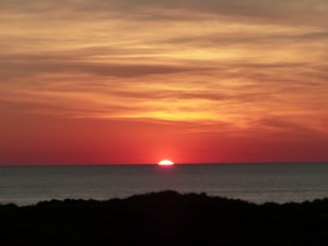
Sunset over the west coast. Is that amazing or what ?

Sunset over the west coast. Is that amazing or what ?

We got to the camp site just before sunset which will probably be the last sunset we see over the west coast as our route now will almost certainly mean we won’t see the coast again until we get to the east coast in Queensland. We might see it again in Derby I suppose.
We were inundated with insects tonight after dark, attracted by the lights at the back of the Land Rover as we cooked. Lots of crickets as well as a multitude of flying bugs of all sizes. We ended up taking refuge in the tent after eating !
Tomorrow we’ll continue past Broome towards Derby, no idea where we’ll stop… We want to stock up on food, water and fuel in Derby before heading out on the Gibb River Road and given the Easter holiday we’re bit certain we can get that done until Tuesday morning. That means if we get to Derby tomorrow we’ll need to stay a couple of nights unless the super market is open on Monday.

Derby

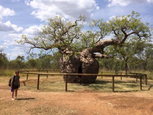
The Prison Boab Tree at Derby

The Prison Boab Tree at Derby

A nice touch this morning at the camp site, the site caretakers went around the camp site handing out mini Easter eggs on their quad. Chocolate for breakfast ? That’ll do nicely 🙂
Another hot and humid day today as, according to weatherzone we were in the hottest part of Australia today with a high of 38C and humidity at around 80%. Not being used to that sort of heat doesn’t make you feel much like doing anything other than driving where with the windows open you can at least get some sort of cooling breeze.
We’re establishing a coping strategy at the moment which works quite well. We start with tea/coffee in the morning in our insulated mugs – it’s strange how refreshing a hot drink can be even in these temperatures. Those keep us going for about an hour on the road by which time we try and find a roadhouse that sells cold bottles of pop that will last us another hour. Pam puts our water bottles in the fridge, full of water and/or orange juice and they come out when we run out of coffee/pop. The final defence is a bottle of mineral water, also in the fridge. We’re easily getting through 5 litres of liquid a day, each, at the moment.
Today our little drive took us 288km to Derby, a small town near the start of the Gibb River Road. Along the way we refuelled at a roadhouse and thankfully the diesel stayed in the tank again so we’re pretty confident now that any leak we have is very minor and won’t cause us issues. The fuel gauge also seems to be working properly on both tanks so we’ve not upset the sender unit on the main tank.
On the road into Derby we crossed a number of rivers and the notes on the HEMA maps make you realise you really are in croc country now. One of the river crossings had a note against it along the lines of “camping and fishing is popular alongside the rover here but there are large numbers of salt water crocodiles so take care”. We didn’t stop for a swim.
On the outskirts of Derby is a very old boab tree that we stopped to see, although we didn’t hang around in the heat too long so a bit of a flying visit… We couldn’t figure out from any of the information how old it is but it’s impressive. Sadly in it’s history it has been used as a kind of land mark and was used as an overnight stop for Aboriginal prisoners being walked in chains to the nearby prison or to Derby for sentencing in the late 19th century. Hence it is known as the Prison Boab Tree.
Once in Derby we got booked into the camp site first and then headed into town to stock up with provisions at the super market and the bottle shop. We also pulled some more cash out of an ATM and will get some more tomorrow as some of the more remote roadhouses only take cash.
All jobs done we set up camp just in time to watch the China F1 Grand Prix live on channel ten. Another poor showing by McLaren with JB finishing out of the points.

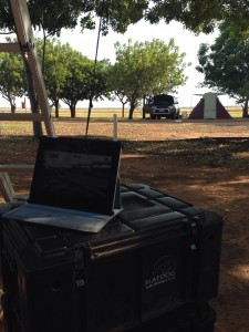
F1 on the iPad, a bit of shade from a tree, chilling at the camp site.

F1 on the iPad, a bit of shade from a tree, chilling at the camp site.

If you look closely at the pic of the camp site you may be able to make out a fence with some long grass behind it… Apparently it’s the crocodile fence, used to keep the salt water crocs in the estuary in the estuary and not in the camp site. I might make extra certain there’s nothing below when I climb down the ladder from the tent though.
Tomorrow we’ll top up the fuel tanks again, hit the ATM for some more cash and then head onto the Gibb River Road. Our first diversion from the road and our first night’s stop will be at Windjana Gorge. Apparently it has a large population of fresh water crocodiles so, again, no swimming but maybe some photo opportunities.
We’re not expecting to have any form of phone/internet coverage for a while now. Updates to the blog and our posts on Facebook are likely to become very sporadic as a result. Don’t panic if you don’t hear from us for a while, we have the sat phone if anything goes wrong !

Windjana Gorge

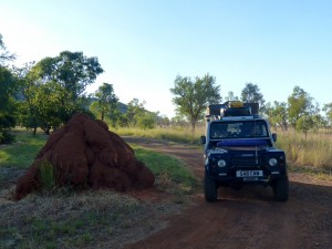
Now that's a large termite mound !

Now that’s a large termite mound !

Life is what happens while you’re busy making other plans – a saying that more often than not seems to be appropriate ! Our plans around the Gibb River Road and how, with the road opening early this year, we’d get the benefit, went out of the window today.
Our first stop this morning was at the info centre in Derby as it was shut yesterday afternoon when we got there. We picked up a current map of the road with details of the different “attractions” along it and had a chat with the person behind the counter. She pointed out that although the road itself was open most of the off shoots are still closed.
Windjana, our intended first destination, is open but the other routes are still closed with no firm opening date. After some deliberation we decided to carry on as planned to Windjana Gorge for tonight.
So, having topped up the fuel tanks yet again we finally set off down the Gibb River Road. The road itself, at least as far as the Windjana turnoff is easy going with most of it being a single lane of Tarmac in the middle of a 2 lane unsurfaced road. It was only when there was traffic coming the other way that you had to drive onto the unsurfaced part. There were some long stretches of gravel road but all in pretty good condition with very little in the way of corrugations or holes.
We arrived at the gorge in the early afternoon and set up camp. It was too hot to consider walking into the gorge this afternoon so we chilled out, reading books and I managed to get a few decent photos of the local wildlife.
Tomorrow we’ll aim to get up at sunrise and walk into the gorge before it gets too hot. Hopefully we’ll get to see some of the crocs. With the rest of the “attractions” along the GRR still closed we’ve decided we’ll take a long side trip to the Bungle Bungles, a national park that we didn’t expect to fit into our route.

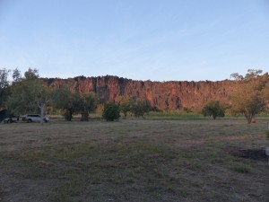
Devonian Reef cliffs at Windjana Gorge

Devonian Reef cliffs at Windjana Gorge

From there we can either continue north to the end of the GRR or double back to complete our journey along the road if the side routes are open by then. It’ll be a real disappointment if we don’t complete the GRR but hanging around waiting for them to open any more than a week will see us with less time around Alice and Mount Dare. It’s probably going to take a couple of days to Bungle Bungle so at least 2 days back and a day or so there. We really want to be in Alice early in May if we can but for the moment at least the decision can be put on hold until we have more info.
Our change of plan does mean we’ll have more internet access than anticipated at least for the next couple of days. Currently we have no phone service at all so this won’t get published to the web site until tomorrow sometime when we get on the Great Northern Highway through Fitzroy Crossing and Halls Creek.

Halls Creek

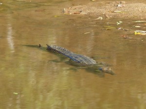
Freshwater Crocodile in the shallows of the river at Windjana Gorge

Freshwater Crocodile in the shallows of the river at Windjana Gorge

Had a good stroll down Windjana Gorge this morning, as per the recommendations we set off early after getting up just after dawn. The last kilometre of the gorge is closed at the moment but the 2.5 km that were open were more than enough !
The track through the gorge was hard going, much of it vague or indistinct and we spent more time than want to pushing through undergrowth. We both have no doubt added to our growing collection of insect bites as a result. It seems every time one finally subsides and stops itching you get another two elsewhere to take it’s place…
Anyway the aim of the excursion was to see the fresh water crocodiles and we certainly achieved that so it was worth the effort and the inevitable scratching for the next few days. We didn’t see any crocs out of the water but saw them swimming and, the one in the picture, basking in the shallows.
The gorge itself is quite stunning when you take your eye off the water or the track ahead checking for snakes. We also picked up some info from the ranger that the other two NP attractions should be open on Friday/Saturday as he is the ranger for those too.

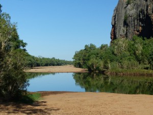
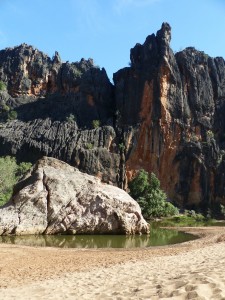
In the bottom of Windjana Gorge

In the bottom of Windjana Gorge

From Windjana we headed south to the Great Northern Highway as planned. As it was still early (a benefit of getting up at 6am I guess) we got to Fitzroy Crossing at around 1pm so decided to push on as the less days we spend travelling to the Bungle Bungles the better really.
We had a change of drivers at one of the free camp spots/rest areas on the way, notable primarily because of all the warning signs about crocodiles – staying 4 metres from the river edge etc… Looked a nice spot actually and quite busy but the timing was all wrong for us.
In the end we covered 437km today, calling it a day when we got to Halls Creek as pushing on to the Bungle Bungles in one go would have seen us traveling in the dark. Halls Creek strikes you as a sad town, struggling with many of the problems that the indigenous population endure. The caravan park is surrounded by high fences and barbed wire and notices and warnings that all valuables should be locked in a vehicle. Glad we’re only here for the one night although the camp site seems pleasant enough, almost like a gated community which is a real shame.

One side of the gorge - The Devonian reef that the gorge has been cut through.

One side of the gorge – The Devonian reef that the gorge has been cut through.

On the return journey, assuming we continue with our plan to complete the Gibb River Road, we’ll overnight at Fitzroy Crossing. The camp site there looked really nice as we passed it. We’ll also try and restock some of our food there as the diversion has stretched us a bit thin. We have enough food with our reserves but it’d be preferable to top them up as we won’t see another supermarket until the end of the Gibb River Road.
Tomorrow we’ll head into the Purnululu (Bungle Bungle) National Park. First stop will be the visitor centre to find out what’s open/closed and then expect to be camping in the NP. Probably no Telstra coverage again…. We’re expecting to stay for two nights before retracing our steps back to continue the Gibb River Road.

Purnululu National Park

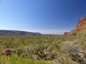
imageFrom Halls Creek to the Purnululu NP is around 150k although the last 60k is unsurfaced and very rough in places. We set off in good time and were surprised, on the Tarmac road, to see hundreds of Black Kites sat along the road. It took us a while to figure out what they were doing as some of the ones that we’re flying would swoop down at the road surface with their talons open.
It soon became apparent that there was some sort of seasonal epidemic of grasshoppers or crickets and they were crossing the road. The kites were determined to make the most of an easy meal.

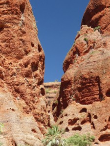
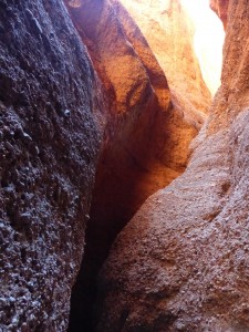
Light reflecting off the red sandstone at Echidna Chasm

Light reflecting off the red sandstone at Echidna Chasm

The unsurfaced track into the national park was good fun for me, bringing back memories of some of the tracks we raced along in the Outback Challenge competitions. The tight turns, descents and climbs with an occasional river crossing were great to drive but Pam was feeling a bit green, not helped by the hot sun that was mostly on the passenger side.
On arriving at the NP we registered for a night’s camping and then headed north to the Echidna Chasm. The tracks inside the NP were, fortunately, much smoother than the track in !
imageI think, like many of the places we’ve seen, it’s difficult to capture this kind of scenery with a camera. The walk through the chasm was fascinating and in some places quite challenging. Rock falls had partially blocked the way at one point and you had to thread your way through the huge boulders. The final part of the chasm was closed, presumably due to similar boulders.

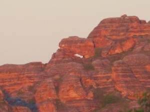
Sunset at the Bungle Bungle Range

Sunset at the Bungle Bungle Range

In the late afternoon we headed back to the camp site, set camp and had an early tea. The camp caretaker came round to let us know what time the sun would set in case we wanted to see the sun come down over the Bungle Bungle Range. As it was only a 1k walk we decided to head to the view point. It’s a very tranquil place, not sure why it should be so, you just have to be there I guess.
I’ll mention the cane toads in tomorrow’s blog when we’ve headed out of the Bungle Bungles and are heading back towards the Gibb River Road.