Category Archives: Australia 2014

Ceduna

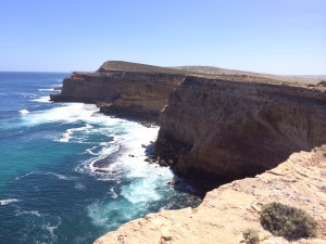
imageWe ended up going a bit further than anticipated today. We left Memory Cove in reasonable time and arrived back in Port Lincoln for around 11am. After handing in the key we then set off North West with the intention of staying the night at Streaky Bay.
With a couple of minor detours and stops (including a cafe that does a marvellous bacon and cheese roll) we started looking at suitable camp sites as we approached Streaky Bay. None of the few available spots appealed to us so we decided to press on to a community site a bit further on at Haslam.
Having arrived at Haslam we found the site absolutely heaving with every available spot and a few more having some form of Motorhome or caravan parked on it. We decided to press on, stopping next at Smokey Bay, again this was full.
imageOur next option was to head to Ceduna with the sun getting lower and us heading more to the west directly into it. Fortunately the caravan site at Ceduna had a space available and the cost wasn’t over the top so we ended up pitching at Ceduna. For some reason there is a quarantine point at Ceduna that was closed when we came through. Seems an odd spot as we’re still 500k from the WA border.
The wind has dropped a bit now but it’s still gusty and keeping the temperatures down. Mid 20s again today during the day.

I seem to have found something approaching the best cruising speed for MPG with today’s fill up after 400+ miles giving over 27 MPG, not sure it’ll be possible to improve on that much without losing some weight/drag from the vehicle.

We’re starting to get to the point where we’ll be crossing the Nullabor, not sure what we’ll have in the way of phone signal/internet access during the crossing so don’t panic if we don’t post anything for a few days !

Nullarbor East

imageWe left Ceduna this morning with an overcast sky and a list of possible side trips so we weren’t sure how far we’d get. We didn’t want to get as far as the WA border as we still had fruit and veg on board for at least one more meal.
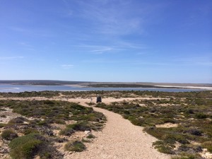
In the end the only real side trip we took was to a place called Fowler’s Bay. It’s not a place I’d recommend anyone to take time to visit ! It did have an interesting road out though which seemed to go straight through a salt marsh or swamp. The road was essentially a causeway being the highest point for a long way around.
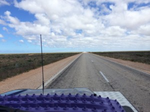
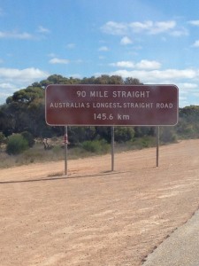
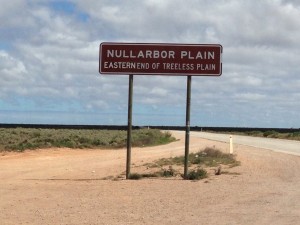
imageBack on the Eyre Highway and before too long we were at the eastern edge of the Nullarbor “treeless” plain. The Nullarbor plain and the road that cuts through it extends for 684 miles (1100 km) and includes one stretch of 91.9 miles that is the longest stretch of surfaced straight road in Australia.

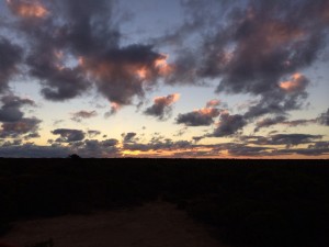
Sunset at the rest area, Nullarbor plain

Sunset at the rest area, Nullarbor plain

Anyway, we’re not going to cover that in a day so we started looking at rest areas for an overnight stop and eventually settled on one about 100km from the WA border that had secluded and sheltered spots well back from the road. It was a pleasant enough spot although the flies would drive us to distraction so we spent the evening in the tent with the panels unzipped.

Nullarbor to Balladonia

imageA very long day in more ways than one, today ! After a decent night’s sleep with the wind dropping and only a couple of brief showers in the night, we decided that we’d have a roadhouse breakfast rather than face the flies again.
The first stop was at the WA border where quarantine checked the 90 over for fruit, veg, honey etc… We’d dumped the last of our fresh fruit and veg in the rubbish bins at the rest area before we set off so no problems and for a quarantine officer the one who searched the 90 was quite pleasant for a change.
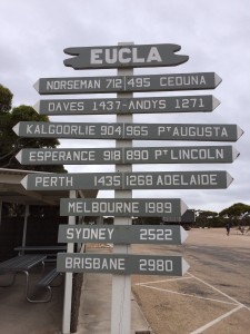
We continued to Eucla and finally got some phone signal again. It seems that at some point we crossed a timeline and having arrived at Eucla at around 10am it was suddenly 8.30am again as our iPhones adjusted to local time, jumping back 1hr 45 mins. On the way we topped off the fuel tanks, the straight, flat highway may be boring at times but we did manage to set a new fuel consumption record – 30.72 MPG which is not just the highest for this trip, it’s the highest we’ve ever managed ! We’ve definitely found the “sweet spot” when it comes to the optimum cruising speed.

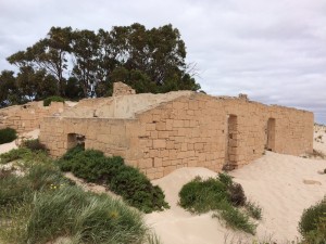
Old Telegraph Station slowly disappearing under the sand dunes.

Old Telegraph Station slowly disappearing under the sand dunes.

At Eucla we took a brief side trip to see the old Telegraph station which is gradually being covered over by a sand dune. It seems that the original telegraph network was built along the coast, presumably so the stations could be supplied by sea.
After that we started the long and fairly tedious journey towards Balladonia, a trip of over 300 miles along the, mostly straight, Eyre Highway over the Nullarbor Plain. At Calguna we crossed yet another time line, adding another 45 minutes to our day. We are now only 8 hours ahead of the UK while we were 10 hours 30 mins ahead this morning !

There were a couple of interesting wildlife sightings which broke up the journey a bit. A couple of Emus who seemed oblivious to traffic gave us a close view – previously we’ve only seen them at a distance, normally running away. We had a VERY close encounter with a Wedge Tail Eagle that was feeding on a roo carcase at the side of the road. As we approached it took off directly into our path, fortunately I managed to avoid it but we certainly got a close up view of it !
90 Mile StraightWe’ve stopped at a rest area about 14k short of Belladonia for the night. Another rest area with tracks and camping areas set back from the road. Even better, there’s no wind, a clear blue sky and hardly any flies 🙂
Tomorrow we will continue to Belladonia and turn off the highway onto the unsurfaced and 4×4 track towards Esperance, hopefully having an easy(ish) day before camping at Cape Arid about half way to Esperance.
Once we get to Esperance on Wednesday we’ll need to restock our food and beer provisions and might spend a couple of nights there to recharge a bit if it’s nice.

Lucky Bay

imageA quick trip down the road to Belladonia for fuel, coffee and muffins 🙂 The roadhouse has a small museum which has replica bits of the Skylab, bits of which were scattered around the region when it re-entered the atmosphere in 1979.
There are also a few exhibits showing the Redex reliability trial which pretty much followed a similar route to the one we’re taking. They did it a lot quicker though and in some pretty basic cars.
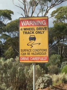
From Belladonia we headed due south in the unsurfaced road, heading to Mount Jagged via the main unsurfaced road and then following the smaller 4×4 only track. At Mount Jagged we swung west towards Esperance intending to stay the night at Lucky Bay as a number of people have recommended it to us.

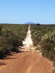
Looking back along part of the track with very soft white sand

Looking back along part of the track with very soft white sand

The track was pleasant, especially the narrow 4×4 only bit, as it wound it’s way through the bush. There were a few sections of really bad corrugations that forced us to a slow crawl but most of it was stretches of rock followed by soft sand followed by more rock. The stretches of white sand were particularly soft and once or twice we thought we might get bogged down in it but a mix of momentum and right foot kept us moving 🙂 Not a track you’d want to try in the wet as some of the big holes and ruts testified.
The corrugations finished off the job of loosening the spare wheel carrier which started making a worrying banging noise after each bump in the track. Once we’d figured out what it was and that it was nothing to worry about we kept going.
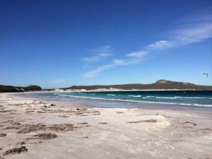
There’s a 12 dollar charge for the Cape Le Grand National Park and the first of the two camp sites was full which was worrying as the second camp site (Luck Bay) is the most widely known. We were starting to have second thoughts having paid the park fee but when you come around the corner on the road to Lucky Bay and see it below you it really is an awe inspiring site. We decided it was worth the fee even if the camp site was full.

Lucky Bay - one of those places where a photo doesn't do it justice !

Lucky Bay – one of those places where a photo doesn’t do it justice !

As it happened there was a spare spot in the camp site so we pitched and went for a wander on the beach, very windy though. We were pitched near another Defender TD5 which belongs to a Swiss couple touring WA having shipped their 110 over. I tightened up the spare wheel carrier where it joins to the back door, we’ll see if it comes loose again later !
No Telstra signal here so will have to post this tomorrow. We’ll be heading into Esparance for fuel and to find a supermarket then heading further west along the coast looking for a nice spot to spend a couple of nights.

Hopetoun, WA

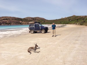
Lucky Bay, sunbathing kangaroo.

Lucky Bay, sunbathing kangaroo.

A comparatively gentle day today as we spent a good part of the morning at Lucky Bay, then a shopping trip in Esparance before getting under way.
After a relaxing breakfast we packed up and drove down onto the beach for a few photos and because we could 🙂 We’d heard about the kangaroos sunbathing on the beach but it was too windy yesterday when we arrived. This morning they were there though and seemed tolerant of humans getting near them. An interesting photo opportunity or two cropped up as a result. Pam was “warned off” by one of the adults when she got a bit close to a youngster but later the same adult started sunbathing and allowed the youngster to get much closer.
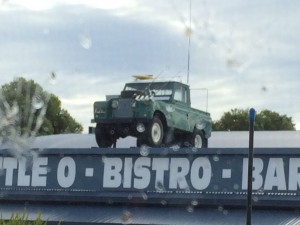
imageAll tarmac roads today again as we headed to a caravan site at Hopetoun that has good reviews on WikiCamps. We’d intended on finding somewhere for a couple of nights but the reviews are misleading. It’s not a bad site but not somewhere we’d want to stay for more than on night. On the way there a couple of points of interest grabbed our attention at the side of the road. Someone has created a Stonehenge replica near the road, which is odd enough, but they’ve then erected a screen and put no stopping signs up to stop people taking photos of it from the road. We also spotted a Land Rover parked on top of a bottle shop, which we did take a picture of !
This area seems a but expensive for camping and at most of the sites they seem to charge over the top and then provide facilities that don’t really match up to the price. Compared to NSW and Victoria at least it doesn’t seem as easy to find good sites that offer value for money. Hopefully things will improve in other areas of WA.
We’re anticipating an early start tomorrow, driving through the National Park on unsurfaced tracks and then cutting west to one of a couple of likely looking spots – we’ll decide which when we get there !

Quinninup

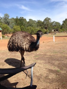
The resident emu at Quinninup (Eno)

The resident emu at Quinninup (Eno)

An early start this morning and we set off as anticipated, heading into the Fitzgerald River NP to explore some of the park’s unsurfaced routes.
Unfortunately it seems that most of the tracks have been closed for regeneration after the 2008 bush fires. As a result we didn’t drive all the tracks we’d intended to but did get a chance to see some of the park and there were a few sections that gave the suspension a workout. Some of the views were quite stunning and probably would have been even better if not for the low cloud !
After leaving the Fitzgerald River.NP we had to decide where we wanted to head to and after some discussion and consulting WikiCamps again we opted for the “Eco Tourist Park” at Quinninup which sounded more like our kind of camp site for a bit of refresher.
We headed North West then cut south through the Stirling Ranges NP before heading into Mount Barker to refuel and see if we could get a month long National Parks permit – no luck with the permit.
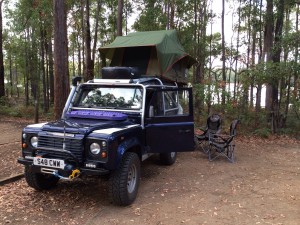
imageThen we just had the long drag west to the camp site. As soon as we arrived we knew this was going to be a much better spot for a 2 night break. Grass pitches, lots of space, kangaroos all over the site and a resident emu. With a pub/tavern within easy walking distance, excellent showers, a laundry, pizza oven and Telstra reception… What more could we ask for (also the cheapest paid site we’ve stopped at in WA so far) 🙂

Update 28th March

Following a night’s stay here we’ve decided to book for a third night. We spent today chilling out and catching up with a few chores. I modified the cigar lighter in the dashboard so it runs off the aux battery and is permanently live so we can charge phones etc… “downstairs” too. Very hot today  but should be cooler tomorrow so we’ll go walking.


Conto’s Field

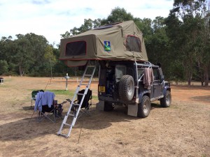
imageOur last full day at Quinninup didn’t give us much of a chance to explore as it turned out. The “scattered showers” turned into a more or less constant rain, forcing us to once again deploy the fly sheet to keep the main tent dry. Fortunately the pub next to the camp site serves excellent food so having been confined to camp by the rain all day at least we could eat well !
The rain continued this morning as we left, heading further west again, although the rain showers became less frequent and shorter with the occasional breakthrough of some sunshine.
We headed first to Pemberton where we finally got our WA National Park permit for the month. It’ll cover us for most of the parks which would otherwise cost $12 a day. We’ll try and utilise as many of the NP camp sites too as with the permit it’ll only cost us $20 a night at those that charge.
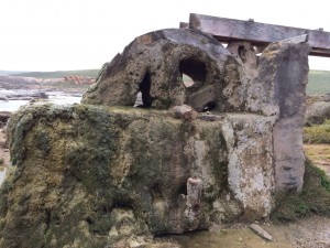
We took a diversion to Augusta, which turned out to be a smaller town than we’d expected. At the end of the peninsula, near the light house, is the old water wheel in the picture. It was used to pump water for the construction of the light house and also for the use of the light house when construction was finished. The water race (still working) is fed from a spring but the water wheel seems to have been petrified by the minerals in it.
From Augusta (via a bakery for a spot of lunch) we headed up the coast into the Leeuwin-Naturaliste National Park, our camp site for the night being about half way up the park. There are a number of caves along the route but we didn’t fancy heading into the one we stopped at – a “challenging” cave apparently that had a ladder system through tight enclosed spaces.
The camp site is of the usual NP standard, good marked out pitches with long drop toilets.
We’ll continue north tomorrow and see where it takes us, the bad weather is supposed to clear in the next couple of days and hopefully that with our northward progress will see us with a bit more sunshine. Temperatures at the moment aren’t too bad but the wind is cold so out of the wind it’s still T shirt weather but missing the high 20s, low 30s we were expecting.

Potters Gorge

Dusk at Potters Gorge

Dusk at Potters Gorge

We took a few detours today as it stayed dry and relatively warm, hopefully we’ve seen the back of the rain and cold winds for a while !
We took a trip down the coast access road from the camp site to start off with. It has a number of different roads that split off it to access different beaches and features. The beaches looked inviting but it was still a bit chilly to encourage either of us to go for a paddle. We also stopped off at the large cave complex but it was a bit expensive for something we weren’t too bothered about so we moved on.
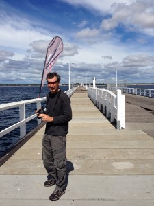
imageWe headed to Busselton then as we’d heard good things about it. By the time we got there the sun had started to warm things up a bit. The jetty at Busselton is 1.8km long, it was longer but part of it was destroyed in a fire in the 90s. It was originally a working jetty used to ship cargo internationally and the shallow slope of the bay and the larger and larger ships using it meant they just kept adding new sections to it. There’s a train service that is marginally faster than walking that runs the length of it. At the end of the jetty is an underwater observatory that has windows at different levels as you descend to the sea bed.
The observatory was worth a look, the number and variety of fish visible was impressive, just shows how little you can actually see from above the surface. After the tour of the observatory we chose to walk back as it was quicker than waiting for the train.
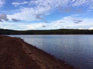
imageFrom Busselton we set off for tonight’s camp site, another National Park site at the side of a reservoir. Once we’d set up and had an early tea we went for a wander down the side of the reservoir. We’re planning to head further north tomorrow, possibly to the outskirts of Perth although we may choose a site somewhere in between this one and the planned one yet, we’ll see how tomorrow progresses…

Pinjarra Park

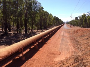
This conveyor belt is 52km long and transports bauxite from the Worsley Mine to the refinery.

This conveyor belt is 52km long and transports bauxite from the Worsley Mine to the refinery.

A short day today and a bit of exploration. We set off to Collie first thing to stock up on provisions at the Coles supermarket.

Leaving Collie we headed into the Harris River State Forest, following mostly unsurfaced tracks. The majority of the tracks were in good condition with few/minor corrugations and the forest made for some decent scenery along the way. There was maybe 5k worth of track with bad corrugations that looked to have had some heavy vehicles along it.

The tracks we used crossed a conveyor belt three times, each time heading over the top of it on a bridge. The conveyor belt has a corrugated tin roof over it but you can see the belt and supporting wheels. The belt is one of the longest in the world and extends for 52km from the mine to the refinery, cutting through the middle of the forest.

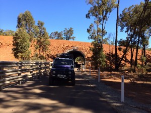
Tunnel through a Bauxite mine track - the very large tipper trucks travel up and down this ramp.

Tunnel through a Bauxite mine track – the very large tipper trucks travel up and down this ramp.

Another sign of the bauxite mining in the area was the long ramp that the road went under in a tunnel. It looked similar to an old incline but MUCH bigger as it was carrying mine tipper trucks rather than a railway.

Having reached the north of the forest by early afternoon we stopped at a collection of camp sites but it didn’t look too appealing so a quick search of WikiCamps threw up a site at Pinjarra Park. It’s not as far north as we’d intended but it’s a nice spot and we’ve moved a bit further north.

Best of all, we seem to have moved our of the weather system that has been giving us clouds and rain for the last few days, clear blue skies and a warming sun – that’s more like it ! Obviously we reserve the right to start complaining about the heat now 🙂

We’ll probably head past Perth tomorrow, either stopping at one of the sites to the North East of Perth or heading to the pinnacles, we’ll see how we feel tomorrow and take it as it comes.

Gingin

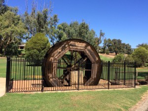
Restored water wheel at Gingin

Restored water wheel at Gingin

Another short hop today, all on Tarmac, as we skirted around Perth to our chosen destination for tonight – a caravan park just to the west of Gingin, north of Perth.
As the journey was primarily made up of driving through the Perth suburbs it was a bit of a shock to the system after getting so used to nearly empty Tarmac roads and completely empty unsurfaced roads.
The journey wasn’t helped by us getting stuck in a queue behind a large load – a mining transporter/tipper on the back of a low loader. The outfit was over 2 lanes wide which meant no overtaking on the dual carriageway sections and it got more interesting on the single carriageway sections as oncoming vehicles, including road trains, were having to risk pulling onto the verges so it could squeeze past. Glad we weren’t in any hurry 🙂

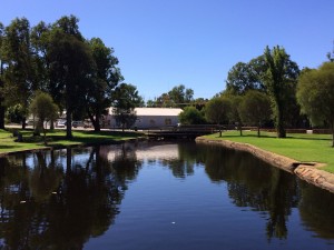
The mill pond at Gingin, the race seems to feed to the wheel from a culvert on the right hand side.

The mill pond at Gingin, the race seems to feed to the wheel from a culvert on the right hand side.

Finally arriving at Gingin we stopped for lunch at the cafe and had a wander around the town. A really nice place as it turned out, well looked after and quite prosperous judging by some of the new houses being built on the outskirts.
Another 10km west and we arrived at the camp site, very friendly place and very relaxed, time for a steak and a bottle of beer or two out of the fridge !
Tomorrow we’ll head to the pinnacles first thing and then to a camp site on the coast which we’ll spend a couple of nights at if it’s nice. Might even go for a swim in the ocean yet.