Simpson Desert Day 1

Dalhousie Springs

Dalhousie Springs

We managed to get away from Mount Dare in good time this morning after topping off both fuel tanks and filling the 20 litre jerry can as insurance. We’ve gone over the consumption figures time and time again now and think we’ve comfortably got enough fuel to make it – I think we could almost make it on just the main tank and jerry can leaving us 60 litres in hand.
We retraced 60km of our route from yesterday back to Dalhousie first thing before turning to Dalhousie Springs for our first stop. The road hadn’t got any better overnight but at least I knew what to expect !
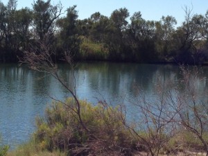
The springs are a natural hot water spring that have created a small lake. The water temperature of the lake is around 36 degrees C so about the same temperature as a warm bath. I had expected the water to smell of sulphur or similar but it seemed odourless. If we’d camped overnight at the springs I’d have been tempted to take a dip !
At Dalhousie Springs there was a notice that the Purni Bore camp site is closed for building work. That was our intended camp site for tonight but we decided with that closed we’d just push on into the desert.

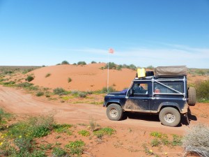
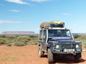
Proper Desert at last !

Proper Desert at last !

The road to Purni Bore was badly corrugated and by the time we got that far we were getting a bit fed up of the constant vibration. From Purni Bore though we started to get into the real desert with sand becoming more predominant than clay and rock. This meant that the corrugations gradually diminished and we just had the soft sand and dunes to contend with.
The first part if the French Line is shared with the other routes that cross the desert. All in all it was pretty easy going with a bit of a rhythm to it as you crested each sand dune, a short flat section then onto the crest of the next dune. None of the established route gave us any issues in high box without diff lock although I did have an experiment on one of the dunes that had been bypassed slightly to see how the Land Rover would behave on the tyre pressures I’d selected. The first two attempts without diff lock failed just short at the crest but with diff lock in it pulled over the crest with little effort on the third attempt so it seems the tyre pressures are somewhere in the right ball park.

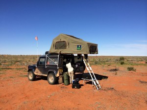
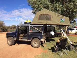
Our fist night camping in the Simpson Desert

Our fist night camping in the Simpson Desert

After the first junction on the track, where the various crossing routes diverge, the track changes character yet again. The French Line becomes a very narrow single track and even in the Land Rover with it’s narrow body we were brushing the bush on either side. The track also develops “humps” which are fairly widely spaced and give the suspension a real workout while limiting the speed you can travel at. A lot of the time we were limited to speeds below 20kph by the humps.
Where we pulled off the track and set up camp tonight (26.20018°S, 136.52490°E) we have covered around 175km of the 500km distance to Birdsville from Mount Dare. We have another 160km of the French Line to cover before Poeppel Corner where we head into Queensland on the QAA track. The French Line is the hardest of the tracks so we’ll take it steady again tomorrow and see how far we get.
It’s great to be able to just pull over anywhere you want and set up camp in the middle of nowhere. Sat here, at least 175km away from any form of civilisation, there’s a real feeling of peace and tranquility. That’s one of the things we’ve both been waiting for I think on this trip. No Mosquitos here so once the sun went down and the really annoying flies departed it turned into a really pleasant evening. There’s a full moon so the stars aren’t bright yet which is a bit of a shame as nothing beats a cloudless night sky in the desert.

Mount Dare

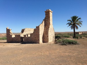
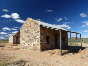
Ruins at Dalhousie

Ruins at Dalhousie

A slight change of plan today as we got to Dalhousie at dinner time and decided we may as well keep going for the extra 55 km to Mount Dare.
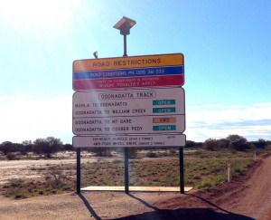
The first part of the route, from Oodnadatta to Hamilton Station was a bit rougher than the Oodnadatta track had been yesterday but we still made good progress along the 100 km stretch. After Hamilton Station the track was pretty bad, having more corrugations and washouts. The final part, from Dalhousie to Mount Dare, was a lot rougher with bad corrugations and some major washouts. It was clear that the track gets flooded on a regular basis and there has been some recent flooding with big ruts in the track.

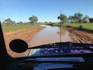
The track at Mount Dare

The track at Mount Dare

As we approached the Mount Dare hotel the track was completely submerged with signs showing an alternate route to bypass what was basically a large pond where the track had been. We had to drive through the last part of the water but it wasn’t deep.
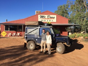
We booked in for the night, bought a sand flag and our desert parks permit and ordered food for later on. (Steak and chips again !). The sand flag was going to be a bit more difficult to attach than I’d hoped but the Mount Dare staff drilled a hole in the winch bumper for me to help secure it so it should be OK. The flag itself is 3 metres high so mounted on the winch bumper it meets the required 3.5 metres from the ground requirement.
Sand flags are mandatory in the Simpson Desert, the idea is that having a tall flag on the vehicle should warn oncoming traffic of your presence, particular when approaching the blind crest of a sand dune.

Mount Dare Hotel

Mount Dare Hotel

We did consider staying here for two nights to keep to our schedule but in the end decided we’d crack on tomorrow and take our time in the crossing. If we arrive at Birdsville a day earlier than planned then we’ll stay an extra night there.
The meal at the hotel was excellent and we had an enjoyable evening chatting to the owners and staff and a group who are also crossing to Birdsville, setting out tomorrow.

Oodnadatta

Oodnadatta TrackWe’ve planned this part of the journey as a series of relatively short hops. The main reason for this is the unpredictability of the unsurfaced roads we’re using.
The trip from Marla to Oodnadata, along the Oodnadatta Track is only about 210 km. The road was mostly in pretty good condition. Patches of corrugations were few and far between and the only hazards were the occasional water holes where the road has been damaged when it’s been driven in the wet.
There are cattle grids along the road too and these had to be treated with respect as the steel plates tend to sit above the road surface. Hitting them at any speed and you can really feel the impact, they could probably slice a tyre if you were unlucky.
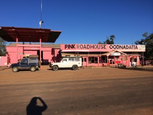
Other than the hazards above we could easily cover the ground at 80 to 90 kph so we arrived in Oodnadatta shortly after dinner time. Our first stop was the Pink Roadhouse to pay for camping and get our desert parks permit. The camping was easily sorted but it seems that, contrary to the government web site, they no longer sell the permits. We’ll have to see if we can get one at Mount Dare.

The Pink Roadhouse

The Pink Roadhouse

The camp site isn’t exactly the best we’ve stayed at but it’s functional ! We’ve had a few nights with broken sleep thanks to noise on the camp sites and we were both pretty tired when we arrived so we had a bit of an afternoon kip in the tent both to catch up on some sleep and to evade the numerous flies that were driving us to distraction !
Tomorrow we’ll head north to Dalhousie, another short trip of around 200km. We might continue to Mount Dare if the road is good and we get there in decent time.

Marla

imageAs planned, a short 250km hop south to Marla today along the Stuart Highway.
Arriving early, around 1pm, gave me a chance to give the Land Rover a look over and tend to a few outstanding jobs. Other than one of the bolts on a rear trailing arm being a little loose all seems fine. I tightened the bolt up on the trailing arm and also nipped up the adjustment on the auxiliary tank filler cap that has been weeping slightly.
Before we hit any deep sand or dunes I’ll probably disconnect the low range sensor on the gearbox as the way the engine ECU reduces the engine power and throttle response at low revs makes driving it quite hard work, especially when I’m more used to driving a big V8 in sand.
Our planned route for the next week, as outlined in yesterday’s post still stands. It’ll be at least 10 days before we drive on bitumen again by which time I suspect we’ll be glad of a smooth, predictable road surface !

Erldunda

Mount Connor

Mount Connor

A bit of a slow news day today as we started one of the more challenging legs of our journey.
After a brief refill stop at the Yulara resort IGA supermarket we headed east on the Lasseter Highway towards the Stuart Highway. The only diversion of the day was a small off piste adventure to see if the tracks marked on one of the maps actually gave access to Mount Connor or not.
The first unsealed track off the highway to Mount Connor was promising enough and gave excellent views of the mountain as we headed along it. Unfortunately the track we then needed to follow to take us to the south of Mount Connor had no entry signs up, similar to ones we’d seen previously with private property signs. We persevered along the gazetted track for another 12k to a second track but this was indistinct on the ground so we decided to abandon our attempt to get closer to Mount Connor and retraced our route back to the highway.
As we neared the Stuart Highway again there was a definite change in landscape as the dense bush opened out into a sparser, flatter, desert like landscape.
At the junction of the Lasseter Highway and the Stuart Highway is the Erldunda roadhouse and we checked in to the camp site there for the night. With our camp set up we then had to make a decision on our route for the next week or so. After some debate we settled on the simplest option, head for Mount Dare via the most obvious route,
Tomorrow we’ll stop at Marla, another roadhouse on the Stuart Highway. That will be the last we’ll see of sealed roads for at least a week. We’ll then set off to Oodnadatta, along the Oodnadatta track where we’ll spend the night and get our desert parks permit. We’ll then head north to Dalhousie where we’ll spend a night. The next step will be to Mount Dare where we will spend the night after sorting out a sand flag. From Mount Dare, after refuelling there we’ll then head back through Dalhousie to the start of the Simpson Desert crossing, stopping for the first night at Purni Bore.
To cross the Simpson we will follow the French Line to Poeppel Corner where we’ll change to the QAA Line to take us into Birdsville. We’re anticipating a 3 or 4 day crossing which covers around 500km without fuel between Mount Dare and Birdsville but we won’t know until we get there. After Purni Bore we will be camping just off the track each night, stopping when we’ve had enough for the day.
It is unlikely we will have any mobile phone or internet access from the time we leave. Marla to our arrival at Birdsville, meaning it will likely be 7 days at least we’ll be “off the grid” as far as Facebook and blog updates are concerned. I should be able to post another blog entry tomorrow night from Marla though if the Telstra coverage map is correct. I’ve put the scheduled stops and dates on the map page, all subject to change as all the best plans are !

Yulara

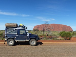
Big Rock, Little Truck

Big Rock, Little Truck

Today was initially a case of getting to Yulara, the resort next to the Uluru – Kata Tjuta National Park. All sealed roads so a pretty straight forward trip saw us arrive at the resort at about 12.30 pm after a single stop to refuel at Curtin Springs.
The campground at the resort had had a power cut earlier, so when we arrived there was a huge queue of people waiting to check in. We had to pay a surcharge as there were no unpowered sites available but we checked in for 2 nights as planned.
Once we’d checked in we headed into the National Park. There are two major features in the national park – Kata Tjuta (Mount Olga) and Uluru (Ayers Rock).

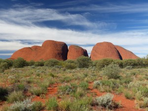
Mount Olga

Mount Olga

Mount Olga was our first destination, after which we drove around Ayers Rock, stopping at the Mutitjula Waterhole before heading to the cultural centre while we waited for the sun to sink a bit.
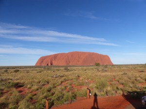
We then headed to the Uluru sunset viewing point and parked up to await the sunset. If I’m honest the sunset was a bit of a damp squib, not helped I’m sure by the cloud cover in the west.

The “coach park” for commercial operators seemed to be better positioned to get a better view than the car park which, in many ways sums Uluru up. On one hand it’s an Aboriginal sacred place but at the same time the commercial operators are given the best viewing areas and seem to call the shots when it comes to public access. Even at the campground one of the commercial operators was tearing a strip off a ranger because he wanted her to park in the queue like everyone else and she felt as a commercial operator she should be given preferential treatment.

Uluru - Ayers Rock

Uluru – Ayers Rock

Ayers Rock itself is an impressive lump of rock and I’m sure it means more to the Aboriginal tribe than just being a cash cow but our misgivings about visiting the place were pretty well founded.

I’m glad we came while we were “in the area” and I’m glad I have seen it but it’s not our kind of place.
Anyway, we’ve done the rock now, got the inevitable photos and tomorrow will be a chill out day at the camp site before we set off towards Mount Dare and the Simpson Desert crossing.
We might take a side trip to Mount Connor on the way out.

Kings Creek

Roma Gorge

Roma Gorge

As planned we set off this morning towards Kings Canyon. Before leaving the West Macs though we diverted off the road to Roma Gorge on the recommendation of the staff at Glen Helen.
To get to the Roma Gorge you drive for 8.5 km along a creek bed, definitely 4×4 only territory this one ! It was reminiscent of many of the special stages we’d competed on the Outback Challenge albeit at a much slower pace. The track twisted and turned it’s way up the creek bed, most of it rocky with the occasional sandy stretch, it probably took about 30 minutes steady driving to get to the end of the track.
The Roma Gorge in itself is nice enough (we really are gorged out now) but the outstanding feature was the quantity of Aboriginal petroglyphs that seemed to cover every available large expanse of flat rock. It seemed everywhere you looked there were different designs. One striking feature was that some of the designs seemed to have a cup and ring design, almost identical to designs found in the UK.

Gosse Bluff Meteor Crater

Gosse Bluff Meteor Crater

Our second stop, again a recommendation, was at a lookout point as we left the West Macs. This lookout gave a superb view of our next stopping point about 20km away, Gosse Bluff. From a distance the bluff looks like a simple but impressive mountain that seems to stand alone in the middle of a plain.
Gosse Bluff is actually believed to be a meteor crater, a circle of mountains surrounding a flat inner plain. The Aboriginal story for the crater also points to it being a result of an impact of an object from space albeit that the meteorite in their story is a baby in a crib that fell from the Milky Way and landed upside down when it’s mother was distracted while dancing. The two parents now search for the star baby, taking the form of two prominent stars.

Kings Canyon

Kings Canyon

Not long after leaving Gosse Bluff we turned onto the 150km unsurfaced road to Kings Canyon where we planned to stay the night. As the road was in pretty good condition we made good time and arrived at Kings Canyon early enough in the afternoon to do one of the gorge walks along Kings Creek.
I’m not sure if we’re just jaded but it was a bit of a disappointment really. If it had been the first such gorge we’d seen we’d have probably been a bit more enthusiastic with the steep red sides with white and yellow ochre patches contrasting against a deep blue sky and lush green foliage. This is the last gorge we plan on visiting for a while on this trip, probably just as well 🙂
Tomorrow we’ll head to Uluru where we’ll be staying for two nights, partly because we could do with a “rest day” before we start our journey to Mount Dare. We should have internet access at Uluru so I’ll be able to post this and the other posts and pictures that are waiting to be uploaded. This next couple of weeks are likely to be the worst for telephone and internet access so posting will be sporadic. We made sure the satellite phone and it’s spare battery are fully charged today, just in case.

http://www.youtube.com/watch?v=e4P7z_9mlJg&sns=em

Glen Helen Gorge

imageDecision made ! This morning we set off into the West MacDonnell Ranges for a relatively short and relaxed drive to Glen Helen Gorge where we’ll stay the night.
No navigation problems this morning as we’ve now just about figured out where everything is in Alice Springs so straight to the fuel station to top up and then straight out on the Larapinta Drive.
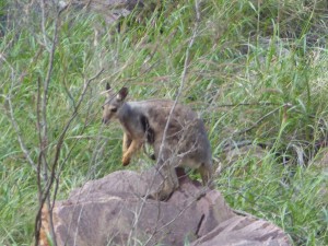
Our first diversion off the road took us to Simpsons Gap, initially this seemed like “yet another gorge” but on the way back we spotted some of the rare Black Footed Rock Wallabies in the rocks on the other side of the gorge to us. We watched them for a while before setting off again.
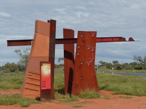
We then turned onto Namatjira Drive towards Glen Helen, following the Red Centre Way.

Black Footed Wallaby

Black Footed Wallaby

There are a series of gorges off the road but we only stopped at a couple of places along the way as we’re starting to get a bit “gorged out”. The Ochre Pits were an interesting diversion as it’s an area of cliffs where the Aboriginals dig out ochre. At these cliffs there are white, yellow, purple and ochres and they’re still being dug today although not when we were there.
Ormiston Gorge had the major attraction of a small cafe serving decent coffee including iced coffee which was very nice, being composed of decent espresso coffee, ice, ice cream, honey, milk and chocolate sprinkled on top.
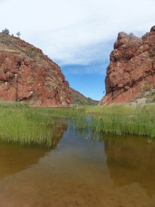
Our final stop was at Glen Helen Gorge which is another gorge… The camp site at the gorge is pretty good with the bonus of a bar and restaurant so we booked in for the night.

Glen Helen Gorge

Glen Helen Gorge

No phone or internet access here so this will have to be posted as and when – probably when we get near Uluru unless we can use the WiFi at the bar here without paying through the nose for it. We’ve bought our permit for tomorrow to cross the Aboriginal lands on the Mereenie Loop down to Kings Canyon. The staff at Glen Helen say the road is mostly in good condition and most of it can be covered at 60kph or more so we should arrive at Kings Canyon early in the afternoon. We’ll stay overnight at Kings Canyon before heading to Uluru where we’ll stay for two nights we think.

East MacDonnell Ranges

One of the views of the Macdonell Ranges from the Ross Highway

One of the views of the Macdonell Ranges from the Ross Highway

Spent today going for a bit of a trundle around the “East Macs” before returning to Alice Springs for the night.
We’d thought a day would be plenty but in all honesty we could have spent 2-3 days there and probably still not visited it all.
We started our day by getting lost in Alice Springs, trying to find a fuel station and then, having refuelled getting lost again trying to get back to the Ross Highway.
When we did eventually “find” the Ross Highway we headed east for the 96km to Arltunga. The first part of the highway is normal 2 lane single carriageway but before long in turns into a layout we’d previously seen on the start of the Gibb River Road. It’s essentially a 2 lane unsealed road but with a single lane of Tarmac running down the middle. This leads to something resembling a game of chicken when there are cars coming the other way. You both have to pass with your offside wheels on the Tarmac and near side wheels on the dirt, it’s just a matter of staying fully on the Tarmac for as long as you can 🙂 I thought I was quite good at it, winning most of the battles but then a road train put me in my place ! Eventually we left the Ross Highway for part of the Binns Track, an unsealed road that takes you the final 33km to Arltunga.

The police house and prison  cell

The police house and prison cell

The scenery either side of the road is fantastic, lots of greenery at the moment against a backdrop of red sandstone mountains.
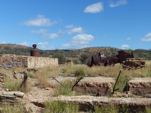
Arltunga itself is an abandoned gold mining town, founded in the late 19th century and abandoned in the early 20th century. Many of the buildings have been rebuilt in an effort to conserve the site. We spent a few hours there visiting the different sites and exploring the buildings and machinery. We got the feeling that at some point the reserve had an injection of cash to build the info centre and museum, rebuild/conserve the buildings etc… but it seems to have lost that momentum. Still fascinating though and in some ways figuring it out for ourselves is more interesting, especially for industrial archeology.

A view of the Cornish boiler, horizontal engine and foundations for the quartz battery

A view of the Cornish boiler, horizontal engine and foundations for the quartz battery

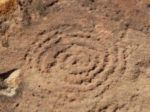
From Artlunga, rapidly running out of day time at this point, we headed back to the Ross Highway before diverting for a trip to the N’Dhala Gorge. There are two attractions that brought us to the N’Dhala Gorge, the first is the 4×4 only track that takes you there and then the Aboriginal artwork when you get there. The track is about 11km long and meanders alongside the Ross River. In places the track crosses the river and on some of the crossings the water is quite deep ! (See video at the bottom of this post)

Aboriginal  petroglyph

Aboriginal petroglyph

When we got to the gorge we just had time to complete the 1km gorge walk and get back again so we could retrace our steps to arrive in Alice before it got dark. As a result it was a bit more hurried than we’d have liked but we saw some of the petroglyphs in the gorge, carved into boulders and apparently telling a story.
On the way back to Alice we got stuck behind a slow moving vehicle that turned out to be a 110 Defender towing a Toyota with a trailer. With all the ribbing we’ve been getting about Land Rover reliability it was quite a poetic sight – obviously Pam took a picture 🙂
Tomorrow we still intend to head west but have yet to decide if we’re going to take 2 days to get to Kings Gorge via the West Macs and the Red Centre Way 4×4 track or if we’ll head direct to Kings Gorge on the surfaced roads. Either way we probably won’t have internet access for a few days.

http://www.youtube.com/watch?v=Vn7iaJlh-eA&sns=em

Alice Springs

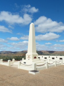
Anzac Hill war memorial, Alice Springs

Anzac Hill war memorial, Alice Springs

As planned today was a short hop of 138km to Alice Springs so we arrived in Alice mid morning.
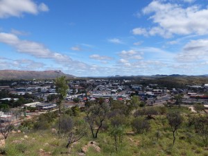
Alice Springs came as a bit of a surprise really. I’m not sure exactly what I’d expected but I had in my minds eye something like a flat red dust bowl with a large cluster of buildings standing out in the middle of a plain. In reality Alice Springs is surrounded by hills and if anything is nestled in valleys rather than standing proud on the plain. Apparently this is a common misconception as, we were assured later, many people have exactly the same reaction when they come to Alice for the first time.
We stopped at the info centre first in the town centre and picked up a few leaflets. The permit we need for the Red Centre Way, that we’d planned to buy at the info centre, is issued for a specific day. This meant that we couldn’t buy it in Alice as we don’t know yet what days we’ll need it for, we can buy it at a couple of locations nearer the track though. You need a permit as the track goes through Aboriginal lands.

A view of Alice Springs from Anzac Hill

A view of Alice Springs from Anzac Hill

We visited Anzac Hill which, as well as being the site of the war memorial, is a large hill near the centre of Alice which offers views across the town. We also visited the war museum at the RSL which was more of a room with some interpretation boards. Some interesting “trench art” though.
A quick romp around the Coles supermarket to refresh supplies and we headed to our chosen camp site in the southern part of Alice Springs. We booked in for one night initially so we could plot our plan of action for the region. Once we’d formulated our plan we then booked in for a second night as we will use the camp site as a base while we explore the eastern part of the MacDonnell range tomorrow (Monday). On Tuesday we will then set off west to the Red Centre Way and Kings Canyon and will probably make it to Uluru on Thursday, that’s the current plan anyway – we’ll see what tomorrow brings first !