Alyuen

The devils marbles

The devils marbles

Back on the Stuart Highway again today, continuing our progress towards Alice Springs.
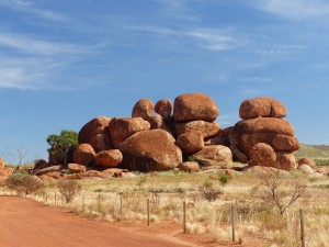
Our first stop was at the “Devils Marbles”, an area covered by large spherical (ish) boulders, many of them apparently piled quite precariously on top of each other. Those that aren’t particularly spherical look as if they were flattened by the weight of others, like balls of clay that were dropped while they were still wet.
The most striking part of the day beyond that has been the weather, or more specifically, the temperature. Having got ourselves into a coping strategy for temperatures in the mid to high 30s during the day and 20s at night we’ve suddenly found ourselves feeling cold ! The temperatures today have been in the mid 20s, dropping below 10C. We never thought we’d get used to the high temperatures and humidity and now find ourselves missing the heat – there really is no pleasing some people 🙂

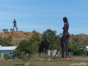
Sculptures at the entrance to the roadhouse

Sculptures at the entrance to the roadhouse

Another stop off on our journey was at the John McDouhall Stuart Memorial which is, from what we can gather, one of three points that can be construed as the centre of Australia. It all depends how you measure it apparently. That particular point was selected by Stuart because of it’s distance between the north and south coasts and east and west coasts. A second point is calculated based on distances from the coastline and a third uses the calculated mass of Australia to find it’s centre of mass. This last method was originally measured using a plumb bob and confirmed with a computer simulation 50 years or so later. We’ve no idea which of the three is correct so will hedge our bets and visit all three if we can !
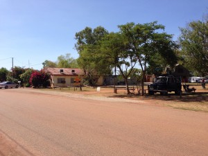
Alyuen is just a stepping point for us, there’s not much here beyond the roadhouse and a caravan site but it does have some striking sculptures that dominate the entrance to the place. I’m not sure how tall they are, the adults are maybe 30 ft tall, really well sculpted and very enigmatic.
Tomorrow we’ll head into Alice Springs and the info centre there to check road conditions, get a permit for the 4×4 route and so on. We also need to re supply with fruit and veg now we’ve crossed yet another quarantine zone. We’ll camp to the south of Alice tomorrow night and plan our next steps as we’ve a lot we want to do in this area. Will have Telstra signal tomorrow so will add pictures to this post then – signal here is very flaky so posting the text to the site will be challenge enough…

Tennant Creek

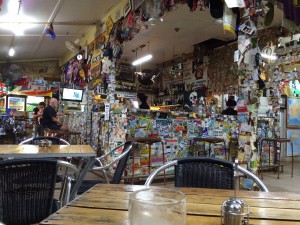
Daly Waters Pub bar

Daly Waters Pub bar

Had an excellent night at Daly Waters, a few beers and a meal in the pub with a live act supplying entertainment. The Daly Waters pub is probably the best pub we’ve visited so far on the trip, a real outback pub.
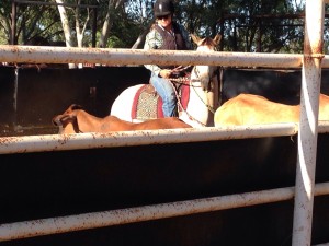
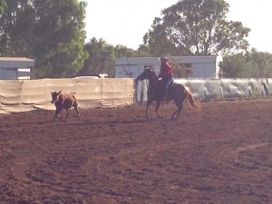
The rodeo dates on the signs were for last year, as it turned out, so the rodeo actually started this morning at 7am. That gave us the opportunity to see one of the disciplines this morning before we hit the road – the Campdraft. Competitors had to start by isolating one of the cattle from the group in the pen and then, once it was isolated, the gate was opened and they had to guide the beast out of the enclosure and around some markers. Sounds simple but the agility and speed required of both rider and horse is quite something. We spent a couple of hours watching the competition before heading on.

Campdraft - cutting out one of the cattle from the pen

Campdraft – cutting out one of the cattle from the pen

We covered just over 400km today in the end, a bit further than we’d anticipated but as we’d set off in good time and the site were we’re aiming for was nothing spectacular we kept going with a couple of breaks at roadhouses and rest areas. The temperatures are dropping off at the moment as we head south too which makes life a bit more comfortable in the cab. The high in Tennants Creek today was 28C and Alice Springs was a balmy 22C – must dig out the thermal undies !
imageThe landscape has changed noticeably today too. The thick layers of trees and undergrowth at the sides of the road has gradually petered out, replaced more and more by scrub and sandstone outcrops. Sometimes, when you come over the crest of a hill, you can see for such a distance you can see the curve of the horizon.
We may end up with a similar distance tomorrow as that will put us in easy distance of Alice Springs, arriving Sunday morning. As always we’ll take it as it comes.

Daly Waters

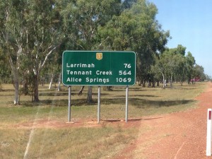
Still a way to go until Alice - signpost at Mataranka

Still a way to go until Alice – signpost at Mataranka

A short hop from Katherine today, heading for another site with a pub !
With only a bit less than 300km to travel today we had a leisurely start before we hit the road and then stopped for second breakfast at Mataranka at a small gallery and coffee shop. Another proper coffee accompanied by fresh baked scones, jam and cream – we may be in danger of adding back on the weight we’ve both lost on the trip so far !
We stopped off at a couple of historic sites at the edge of Daly Waters.
There is an airstrip which made Daly Waters an important hub in the early years of international and national aviation as well as playing a role in World War 2 as a base for bombers, a hub for refugee flights and air defence during the bombing raids against Darwin and Katherine. The main hangar is still standing and contains an interpretation display although it has seen better days !

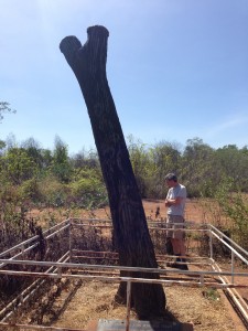
The Stuart Tree, Daly Waters

The Stuart Tree, Daly Waters

Near the airfield is the “Stuart Tree” which is the remains of an old tree trunk, significant because it has a letter S carved in it that was carved by members of the Stuart expedition that opened up a route between Adelaide and Darwin in the late 19th century. The Stuart highway is named after the same expedition and it’s leader.
Arriving at the Daly Waters Pub, our stop for the night, we were surprised to see it so busy – it turns out that there is an annual rodeo held here on the first weekend of May. It’d be nice to stay and watch part of the Rodeo but it doesn’t seem like anything much will be happening until Saturday Night which would mean staying here for at least 3 nights. Perhaps after a few beers at the pub we may reconsider but realistically I think the timing is impractical.

Easy walking/staggering distance of the pub !

Easy walking/staggering distance of the pub !

So, tonight we’re camped very close to the pub on a camp site that is rapidly filling up with caravans of all sizes – it reminds me a bit of Billing with people trying to save a spot for “a friend who’s arriving later”, the lone “caravan marshal” has our sympathies 🙂

Katherine

Escarpments alongside the Victoria Highway

Escarpments alongside the Victoria Highway

We’d intended to have a steady day today. We started off early, leaving the camp site and getting into town before 8am. We stocked up on food (no veg or fruit.in preparation for the quarantine areas) for a few nights at the supermarket and fuelled up at the roadhouse in town.
We then set off towards Timber Creek, our expected stopping point between Kunnunara and Katherine.
Before too long we crossed into the Northern Territories, saying a fond farewell to WA. That also meant we crossed a time zone pushing the clocks forward by an hour and a half. Psychologically that gave us a shorter day although obviously it would also mean it’d stay light until gone 6 pm.
The two Timber Creek camp sites, or at least their descriptions on WikiCamps, were uninspiring and at a rest area before we got to Timber Creek we took the decision to go straight through to Katherine and then stop there for two nights. It would mean travelling 511km in the day but between the two of us we’ve done it before and the site at Katherine sounded more appealing.
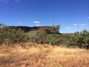
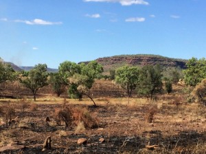
IMG_0943The Victoria Highway which we were following is another attractive road that runs primarily along the valley bottoms with escarpments on either side. Lots of small bush fires along the sides of the road which we think are deliberate, burning back the undergrowth after the wet season to create “natural” fire breaks.
So, we pushed on, arriving in Katherine at around 4.30pm. The site is very nice, lots of grass and lots of space. There are also lots of posters and warnings about the local salt water crocs – the swimming pool is the only place we’ll be swimming this far north !
Katherine is probably the furthest north we will get on this trip, when we leave on Thursday we’ll be heading south towards Alice Springs. Tomorrow will probably be a rest day, hopefully the humidity will drop a bit. Alice Springs is around 10 degrees cooler in the day at the moment, which sounds nice 🙂

Kununarra

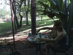
Breakfast at Ellenbrae - a Devonshire Tea on the veranda

Breakfast at Ellenbrae – a Devonshire Tea on the veranda

Our last day on the Gibb River Road today. We started the day off with a very nice breakfast at Ellenbrae Homestead with fresh home made scones with jam and cream, washed down with tea/coffee. They really were superb scones and we had an interesting chat about life on the homestead, particularly during the wet season. Anyone travelling along the Gibb River Road should make Ellenbrae a compulsory stop !
Yesterday evening there had been a few heavy looking clouds around when we set up camp and we even had a spot of rain in the early hours. We found out over breakfast that Exmouth was cut off by flooding over the weekend with the main road in and out closed off.
As we continued along the final 100k or so of unsurfaced road the GRR continued to throw up new vistas that took your breath away. The road also gave us the biggest river crossing of the trip so far as we crossed the Pentacost River.
As we approached the crossing we could see a couple of vehicles on the other bank with people milling about, presumably trying to decide if the crossing was safe. There were markers at the side of the crossing with no depth indication on them so all we could do really was trust in the Land Rover and head on in. Even with a willing navigator this isn’t an area of the country you can send someone in on foot to test the depth…
As expected the crossing wasn’t a problem, a bit rough with some fairly large rocks under the water but not too deep. The deepest part was in the middle of the second channel where I could feel the water hitting the bottom of the footwell but nowhere near the point that the Land Rover would have an issue and we kept our feet dry 🙂
It didn’t seem much longer on before we met up with the surfaced road again and pretty soon the Gibb River Road came to an end at a T junction with the Wyndham to Kununarra road.
As we headed into Kununarra it was clear we were heading into heavy rain. Although temperatures were still in the mid 30s it was throwing it down when we booked into the Big4 site for the night. The rain was short lived and the clouds dispersed but the humidity was ridiculous. Sat in the shade we didn’t feel that hot compared to some parts of the trip but the sweat was dripping off us due to the high humidity. It reminded me of Singapore airport when you cone out of the air conditioned terminal and seem to walk into a wall of very hot water vapour.
The camp site was offering a charity fundraiser “Beef and Barra” night for 10 bucks a head so we signed up for that and, after a shower, spent the late evening sat by the lake for the communal get together. We had a really nice evening swapping tales and comparing notes with others on their journeys. The site’s friendly freshwater croc “George” didn’t put in an appearance so I’ll have a wander in the morning. There were some turtles in the water though and a LOT of big catfish around when the excess bread from the meal was thrown into the water.
Tomorrow we’ll continue our journey to Katherine, if it weren’t for the humidity we’d probably stay here another night but the thought of sitting still here during the day doesn’t bear thinking about. We’ll stock up on food and fuel before we leave town though.

Ellenbrae Homestead

Near the top of Bell Gorge

Near the top of Bell Gorge

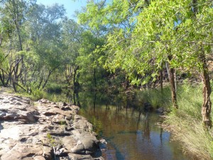
Our first “task” this morning was to walk to the Bell Falls, along the Bell Gorge. The walk was challenging in places and quite rough going until we got to the river crossing where you have to pick a route through the pools and rocks at the head of the waterfall that minimised wading. As the water was so clear we elected to make the crossing barefoot rather than have wet boots for the rest of the walk.
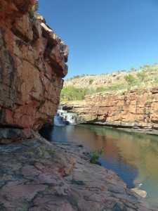
The falls and surrounding canyon were impressive and once we’d got to the end of the marked route we just sat and took it all in for a while before heading back.

The Bell Falls

The Bell Falls

Heading back out onto the Gibb River Road our next destination was the Imintji Roadhouse which turned out to be an oasis on the dusty road. It seems a long time since we’ve found anywhere offering decent coffee but at Imintji they serve excellent coffee and the fresh made muffins were just as good and nicely presented. We sat in the shade in the garden area and planned the rest of the day.
There were a few options for places to stay along the rest of the GRR but in the end we opted to try and make it as far as Ellenbrae, a camp ground that was a good distance along but has excellent reviews on WikiCamps. It meant driving just over 300k, all on unsurfaced roads, but would leave us an easier day tomorrow being within 150k of the end of the Gibb River Road and the surfaced road.

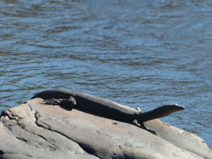
A lizard basking above the Bell Falls

A lizard basking above the Bell Falls

The Gibb River Road itself is a really attractive road to drive. Along with the challenges of an unsurfaced road that normally keep the driver busy the scenery constantly changes. You start to take for granted the huge vistas that seem to appear at the top of every hill and the lush trees and bush that surround the road. The road surface is pretty good but you have to be vigilant as you can be lulled into a false sense of security as you trundle along at 50mph and suddenly find a rough creek bed in front of you. We even came across a fallen tree covering most of the road where a small bush fire had burnt through the base of it’s trunk.
Ellenbrae itself is a nice camp spot at a homestead. Nicely laid put facilities and not badly priced. They also serve scones with jam and cream from 8am so that’s breakfast sorted !
Tomorrow we should complete our crossing of the Gibb River Road and will be back on tarmac for a while. We’ll head to Kunnunara and Katherine before turning south towards Alice Over the next few days.
We’re just over half way through our trip now, time wise, and have covered over 8000 miles since leaving Sydney.

Silent Grove

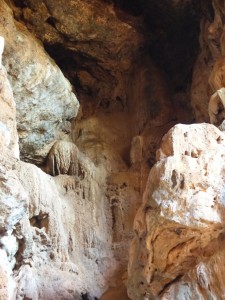
Formations at the start of Tunnel Creek

Formations at the start of Tunnel Creek

After a restful stop at the Fitzroy Crossing Lodge, including two nights of eating out and sampling the draught beer, we returned to the Gibb River Road today after topping up our fuel and water at the Fitzroy Crossing fuel station.
Our first stop was at Tunnel Creek, just off the Leopold Downs Road. We’d passed it on our way out from Windjana Gorge but hadn’t stopped last time. This time we stopped off for a look.
Tunnel Creek is a subterranean creek that cuts through the Devonian Reef for around 2km. The quartz rich rocks and boulders you have to clamber over to get into the tunnel/cave system are quite daunting and then, once you enter the tunnel you need a torch to proceed. There aren’t any signs to show the way and once we were confronted with having to wade through water of indeterminate depth, in the dark, with no idea if we needed to go left or right, we decided not to go any further.

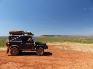
One of the many vistas that just seem to appear from nowhere on the Gibb River Road

One of the many vistas that just seem to appear from nowhere on the Gibb River Road

From Tunnel Creek we rejoined the Gibb River Road proper, resuming our journey east along it to head to the, hopefully now open, Silent Grove camp ground. The scenery along the GRR a this point is stunning and the road itself is mostly in good condition although it did seem to deteriorate with more holes and corrugations the further east we got. The road is now open to road trains too, they kick up a LOT.of dust compared to normal 4x4s so when you see one coming the other way it’s as easy to almost stop while the dust disperses.
P1010201Thankfully when we got to the Silent Grove turnoff there was a sign declaring that both Silent Grove and Bell Falls are open. Although it was still early afternoon neither of us fancied the 4km walk to Bell Falls and back in the heat of the day so we set up camp early with the intention that we’ll get going early in the morning and try to cover some of the walk while it’s still relatively cool.
As anticipated, there’s no internet here so not sure when I’ll get to post this to the blog !

Fitzroy Crossing

Cathedral Gorge

Cathedral Gorge

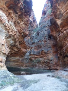
First thing this morning we took a trip to the southern part of the Purululu National Park to see the Cathedral Gorge. We’d expected it to take a while but combined with our early start we’d completed the walk by 9am. As a result we decided to have a bit of a marathon day and try and make it all the way to Fitzroy Crossing before dark.
Last night we came across something first hand that we’d known about through documentaries and so on but never expected to come face to face with the reality. On our walk to see the sunset we noticed a lot of dead toads on the track leading to the view point which, from the information on the various boards we’ve seen, all looked to be cane toads.
As it got darker it was apparent that the area is completely overrun by them, everywhere you walked on the roads or in the camp site you’d see them hopping away from you. The camp caretaker rounded up 300+ last night and they’ve barely made a dent in the population. Now alerted to them, during the drive out of the park, every creek/River crossing we made saw loads of the cane toads running off the road. We tried to do our bit by running over as many as possible ! They are an introduced species that is playing havoc with the local wildlife, sending some species into extinction.
imageAnyway, today we made a dash for Fitzroy Crossing, 500k in total but by sharing the driving and with suitable selection of loud music we made it in time to set up camp before the sun went down. It’s one of the best things about this country, you can stick at 100km/h for 5 hours and not see another vehicle in front of you.
We’ve booked in here for 2 nights as it has a bar, a restaurant, a pool and a laundry. We’ll then set off refreshed on Saturday morning to the Gibb River. Road again and this time we’ll drive what is open.

We’ll be out of phone/internet contact for a few days now so I’ll probably be unable to post any more blog entries until we reach the end of the Gibb River Road.

Purnululu National Park

imageFrom Halls Creek to the Purnululu NP is around 150k although the last 60k is unsurfaced and very rough in places. We set off in good time and were surprised, on the Tarmac road, to see hundreds of Black Kites sat along the road. It took us a while to figure out what they were doing as some of the ones that we’re flying would swoop down at the road surface with their talons open.
It soon became apparent that there was some sort of seasonal epidemic of grasshoppers or crickets and they were crossing the road. The kites were determined to make the most of an easy meal.

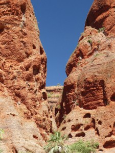
Light reflecting off the red sandstone at Echidna Chasm

Light reflecting off the red sandstone at Echidna Chasm

The unsurfaced track into the national park was good fun for me, bringing back memories of some of the tracks we raced along in the Outback Challenge competitions. The tight turns, descents and climbs with an occasional river crossing were great to drive but Pam was feeling a bit green, not helped by the hot sun that was mostly on the passenger side.
On arriving at the NP we registered for a night’s camping and then headed north to the Echidna Chasm. The tracks inside the NP were, fortunately, much smoother than the track in !
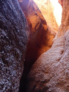
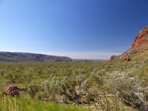
imageI think, like many of the places we’ve seen, it’s difficult to capture this kind of scenery with a camera. The walk through the chasm was fascinating and in some places quite challenging. Rock falls had partially blocked the way at one point and you had to thread your way through the huge boulders. The final part of the chasm was closed, presumably due to similar boulders.

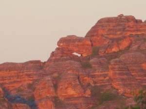
Sunset at the Bungle Bungle Range

Sunset at the Bungle Bungle Range

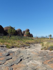
In the late afternoon we headed back to the camp site, set camp and had an early tea. The camp caretaker came round to let us know what time the sun would set in case we wanted to see the sun come down over the Bungle Bungle Range. As it was only a 1k walk we decided to head to the view point. It’s a very tranquil place, not sure why it should be so, you just have to be there I guess.
I’ll mention the cane toads in tomorrow’s blog when we’ve headed out of the Bungle Bungles and are heading back towards the Gibb River Road.

Halls Creek

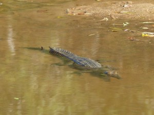
Freshwater Crocodile in the shallows of the river at Windjana Gorge

Freshwater Crocodile in the shallows of the river at Windjana Gorge

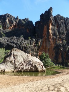
Had a good stroll down Windjana Gorge this morning, as per the recommendations we set off early after getting up just after dawn. The last kilometre of the gorge is closed at the moment but the 2.5 km that were open were more than enough !
The track through the gorge was hard going, much of it vague or indistinct and we spent more time than want to pushing through undergrowth. We both have no doubt added to our growing collection of insect bites as a result. It seems every time one finally subsides and stops itching you get another two elsewhere to take it’s place…
Anyway the aim of the excursion was to see the fresh water crocodiles and we certainly achieved that so it was worth the effort and the inevitable scratching for the next few days. We didn’t see any crocs out of the water but saw them swimming and, the one in the picture, basking in the shallows.
The gorge itself is quite stunning when you take your eye off the water or the track ahead checking for snakes. We also picked up some info from the ranger that the other two NP attractions should be open on Friday/Saturday as he is the ranger for those too.

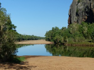
In the bottom of Windjana Gorge

In the bottom of Windjana Gorge

From Windjana we headed south to the Great Northern Highway as planned. As it was still early (a benefit of getting up at 6am I guess) we got to Fitzroy Crossing at around 1pm so decided to push on as the less days we spend travelling to the Bungle Bungles the better really.
We had a change of drivers at one of the free camp spots/rest areas on the way, notable primarily because of all the warning signs about crocodiles – staying 4 metres from the river edge etc… Looked a nice spot actually and quite busy but the timing was all wrong for us.
In the end we covered 437km today, calling it a day when we got to Halls Creek as pushing on to the Bungle Bungles in one go would have seen us traveling in the dark. Halls Creek strikes you as a sad town, struggling with many of the problems that the indigenous population endure. The caravan park is surrounded by high fences and barbed wire and notices and warnings that all valuables should be locked in a vehicle. Glad we’re only here for the one night although the camp site seems pleasant enough, almost like a gated community which is a real shame.

One side of the gorge - The Devonian reef that the gorge has been cut through.

One side of the gorge – The Devonian reef that the gorge has been cut through.

On the return journey, assuming we continue with our plan to complete the Gibb River Road, we’ll overnight at Fitzroy Crossing. The camp site there looked really nice as we passed it. We’ll also try and restock some of our food there as the diversion has stretched us a bit thin. We have enough food with our reserves but it’d be preferable to top them up as we won’t see another supermarket until the end of the Gibb River Road.
Tomorrow we’ll head into the Purnululu (Bungle Bungle) National Park. First stop will be the visitor centre to find out what’s open/closed and then expect to be camping in the NP. Probably no Telstra coverage again…. We’re expecting to stay for two nights before retracing our steps back to continue the Gibb River Road.